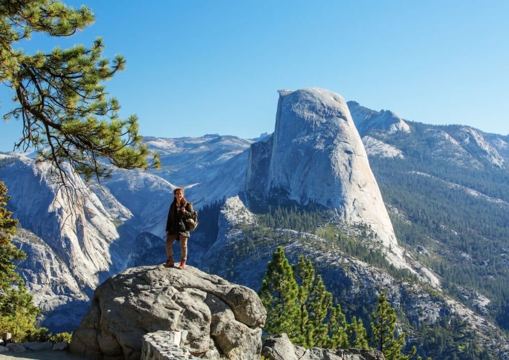
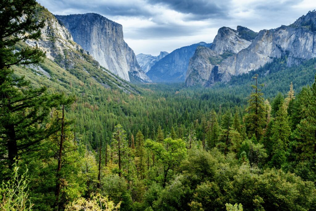
Uncover 30 unique hiking trails in Yosemite National Park, from popular routes to hidden gems. Dive deep into Yosemite's wilderness with this guide.
Think you’ve seen all that nature has to offer? Think again. Yosemite National Park, set within California’s vast wilderness, breaks every mold.
Beyond the iconic waterfalls and granite behemoths, we’ve discovered trails that even seasoned hikers rarely tread. This isn’t just another list; it’s your passport to experiences few have had the privilege to encounter.
So, are you ready to tackle Yosemite in a way most only dream of? Let’s dive in.
Most Popular Hikes in Yosemite National Park
Within the vast network of trails in Yosemite National Park, there are some standout hikes that have gained popularity due to their scenic beauty, accessibility, and unique features.
These popular hikes offer something special for everyone, whether it’s breathtaking vistas, iconic landmarks, or captivating natural wonders. Let’s explore these top trails that continue to enchant and inspire visitors from around the world.
The Half Dome Hike
Basics: 14 miles round trip, 5,300 ft. gain, difficult
The Half Dome hike is a challenging one. It’s a 14-mile round trip hike that gains over 5,000 feet of elevation. The hike starts at the Happy Isles trailhead, located just south of Curry Village.
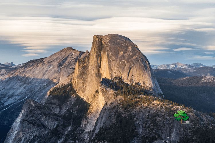
The trail winds its way through forests and meadows until you reach the top of Vernal Falls. At this point, you can choose to continue on to Nevada Falls or head back down to Happy Isles if you’re not feeling up for the full Half Dome hike.
Once you reach the top of Vernal Falls, it’s about another mile and half to get up to the cables section of your trek. Make sure you stop at the Vernal Fall footbridge before starting up this part of your journey!
You’ll have to cross it before heading up the steep switchbacks that lead up to Half Dome’s shoulder (don’t worry — there are chains along the way).
Once at the shoulder, you’ll see a set of cables leading up towards Half Dome’s summit; climb those instead of hiking around them! Once at the summit, enjoy views that stretch all around you 🙂
Upper Yosemite Falls Trail
Basics: 7.6 miles round trip, 2,600 ft. gain, difficult.
The trail head is located at the top of the Yosemite Falls parking lot, which is just below Yosemite Lodge at the Falls. The trail follows the north rim of Yosemite Valley on its way to Upper Yosemite Fall and Vernal Fall.
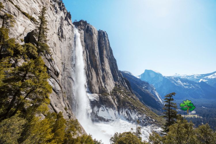
The trail runs along the base of Sentinel Rock and crosses several small footbridges before reaching a junction with Panorama Trail at 1.5 miles round trip. A short spur leads to a viewpoint above Vernal Fall.
Upper Yosemite Falls is a short distance beyond Panorama Trail junction on your right. If you want to go farther than Upper Yosemite Falls and don’t mind getting your feet wet, continue on the main trail until you reach the top of Nevada Fall and then follow Merced River upstream for another mile or so to see Royal Arches, Washington Column and North Dome from Tunnel View.
Mist Trail to Vernal & Nevada Falls
Basics: 7 miles round trip, 1,900 ft. gain, moderate
The Mist Trail to Vernal and Nevada Falls is a moderate hike that takes you through a lush forest, past a waterfall, and up a granite staircase. The trail is one of the most popular in Yosemite National Park, so it can get crowded. But if you go early in the morning, you’ll avoid the crowds and enjoy the solitude on this beautiful hike.
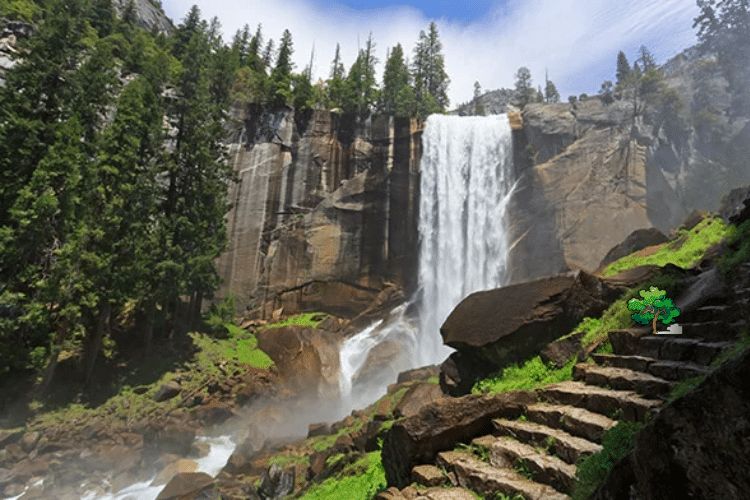
The trail starts from Happy Isles near the parking lot for Curry Village. It’s about 1 mile to Vernal Fall with an elevation gain of about 200 feet. At the top of Vernal Fall, there’s a platform where you can get above the falls and look down at them from above (or in this case below).
From here continue up another 0.75 miles to Nevada Falls which has an elevation gain of 500 feet over 0.8 miles (1.5 km). This section has many switchbacks as you climb up through a forested area with large boulders along the trail.
You’ll also pass through several tunnels which provide some cool shade on hot days or when hiking in early morning or late afternoon when temperatures are warmer (it can be quite warm during summer months).
Mirror Lake Hike
Basics: 2.4 miles round trip, 100 ft gain, easy
This easy hike to Mirror Lake is one of the most popular in Yosemite National Park. The trailhead is located off of Glacier Point Road, and it’s a 2.4-mile round trip hike with an elevation gain of 100 feet.

The trail is wide and easy to follow, but the last portion of the hike can be quite muddy and slippery after rain. If you’re planning on hiking this trail after it rains, make sure you bring appropriate footwear!
The Mirror Lake Trail is an excellent choice for families with children and anyone who wants to enjoy the beauty of Yosemite without having to climb any major peaks or navigate difficult terrain. The entire trail is paved, and there are plenty of places along the way where you’ll be able to stop for photos or just enjoy being surrounded by nature.
From May through September, visitors can take advantage of a free shuttle bus that runs between several popular destinations in Yosemite Valley including stops at Half Dome Village, Happy Isles, Tenaya Lodge & Cabins, Yosemite Lodge at the Falls and Yosemite Village.
Sentinel Dome Trail
Basics: 2.2 miles round trip, 400 ft. gain, easy
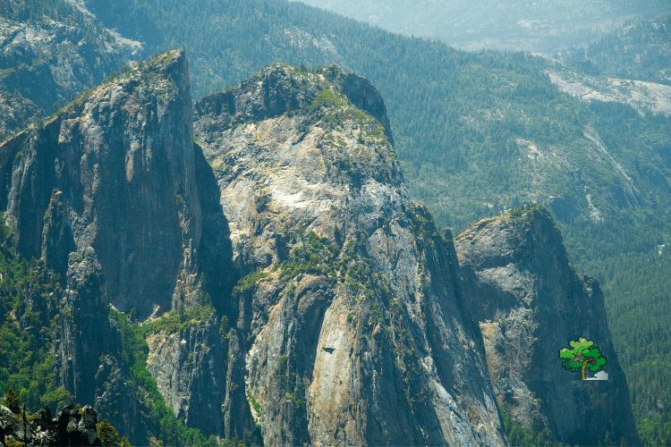
The trail climbs to one of the park’s most prominent landmarks, a granite dome with stunning views of Yosemite Valley and Half Dome. The hike is short, easy and beautiful — it’s a must for any visitor interested in getting up close and personal with Yosemite Valley’s granite walls.
The Sentinel Dome Trail is a short loop that begins near Sentinel Bridge, which spans the Merced River near El Capitan Meadow. The trail follows an old dirt road up to the top of Sentinel Dome (8,122 feet), passing several meadows along the way. At the top there are several viewpoints looking down into Yosemite Valley as well as views of El Capitan and Half Dome from across the valley.
The hike begins at a small parking lot near Sentinel Bridge in Yosemite Valley. From here follow the trail past some information signs before reaching some switchbacks on your left. Follow these up to another junction where you’ll see another set of switchbacks on your right. Take these switchbacks up to a flat section just below Sentinel Dome itself (you’ll know what it looks like).
Mariposa Grove Trail
Basics: 7 miles round trip, 1,200 ft. gain, moderate
The Mariposa Grove is home to the largest collection of mature giant sequoias in Yosemite National Park. The historic Wawona Road offers spectacular views of this grove, which has been protected since 1890.
The Mariposa Grove of Giant Sequoias is a must-see for anyone visiting Yosemite National Park. This grove is home to some of the oldest and tallest trees in the world. The trees are protected within the boundaries of Yosemite National Park, and you can visit them on your own or take a guided tour with a park ranger.
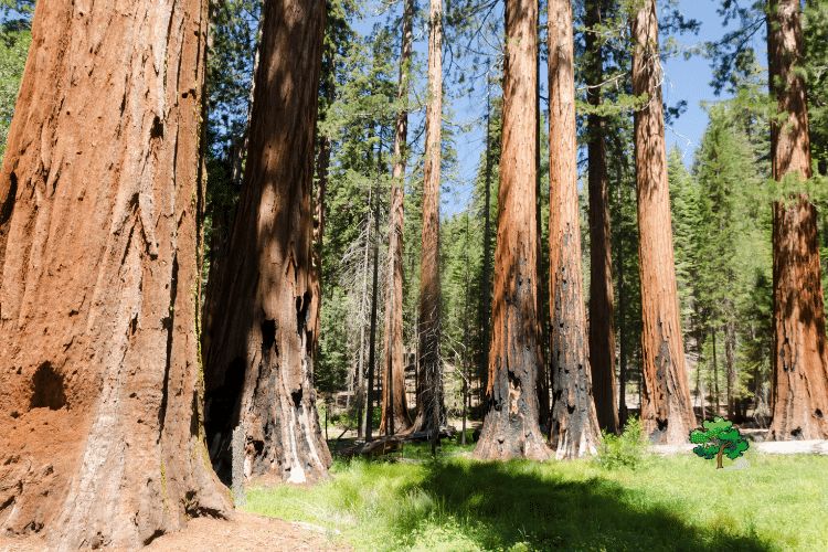
The trail begins at the Mariposa Grove Museum and heads uphill through a forest of pine and fir trees. The trail climbs steeply, passing through several switchbacks before reaching the Mariposa Grove.
There are no restrooms or drinking fountains at this trailhead, so be sure to stop at one of these along your way:
Lower Pines Campground (0 miles)
Yosemite Valley (1 mile)
Big Oak Flat Entrance Station (2 miles)
The trailhead for the Mariposa Grove is near the south entrance to Yosemite, about a 20 minute drive from El Portal or Fish Camp, or about a 2 hour drive from Oakhurst.
This hike takes you through some cool areas, including a couple forested areas, and then along creek beds where you can see the giant sequoias up close.
The trail winds around through the groves and eventually loops back to the beginning to make it 7 miles round trip.
Mono Pass Trail
Basics: 7.4 miles round trip, 900 ft. gain, moderate
Mono Pass Trail is from the Tioga Road that leads to Mono Meadow, which is an excellent place to stop for lunch or spend the night. It’s one of the best places in the park for wildflowers and springtime wildflower viewing.
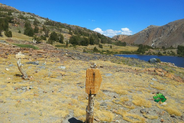
The trailhead is located just north of Tuolumne Meadows Campground, about 2 miles up the Tioga Road. The first couple of miles are fairly flat, as you make your way through forest to Mono Meadow. You’ll pass several small streams along this stretch of trail.
As you get closer to Mono Meadow, you’ll start climbing more steeply up switchbacks that take you through pine forest and into a meadow filled with wildflowers and other plants (depending on the season). The top of this climb is a saddle between two peaks called Mono Pass. From here, there are panoramic views of Yosemite Valley, Half Dome and Tenaya Lake below as well as some good views into Nevada’s Mono Lake basin to the east.
Elizabeth Lake Trail
Basics: 4.9 miles round trip, 900 ft. gain, moderate
Elizabeth Lake Trail is one of the most popular trails in Yosemite National Park. The trailhead is located at the western end of the Tuolumne Meadows Campground, which has a small parking area. The trail is well marked and easy to follow.
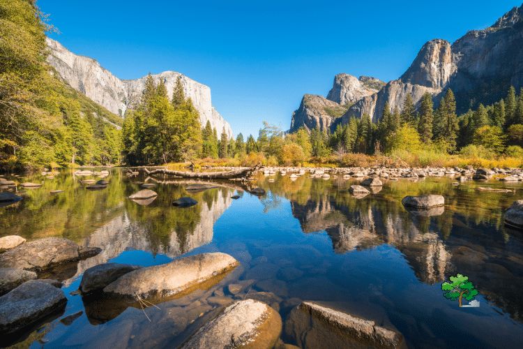
The hike starts out on an old road that was used to bring supplies into Tuolumne Meadows before the construction of Tioga Road in 1937.
The trail climbs steadily through a forested area and eventually reaches a junction with Lembert Dome Trail, which leads west to Lembert Dome. This junction is about 1 mile from the trailhead, so if you are doing this as a loop hike continue straight ahead at this point.
The remaining 0.3 miles are steep but short as you climb up to Elizabeth Lake. There are several places along this stretch where you can rest and catch your breath before reaching the lake itself.
Elizabeth Lake sits at 8,200 feet elevation and has glacier-fed water year round that stays cool even on hot summer days because it comes directly out of granite bedrock instead of through soil or gravel like most other lakes in Yosemite Valley do.
You can spend time swimming in Elizabeth Lake or just relaxing near its shoreline before heading back down.
Cathedral Lakes Trail
Basics: 8 miles round trip, 1,200 ft. gain, moderate
Cathedral Lakes Trail is a popular hike in Yosemite National Park that starts near Glen Aulin, just beyond Tuolumne Meadows. The hike is 8 miles round trip with 1,200 feet of elevation gain. The trailhead is located at the Cathedral Lakes parking lot on Tioga Road.
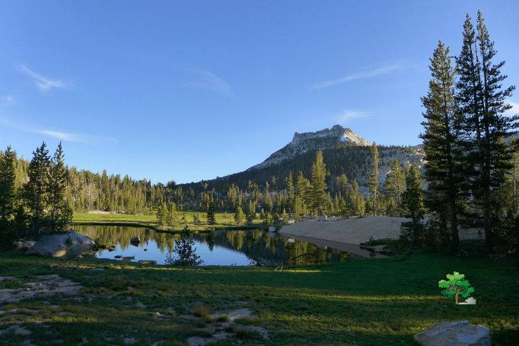
The trail to Cathedral Lakes starts out steep but then levels out as you reach the top of Vernal Falls. You’ll get some great views of Vernal Falls along this section of the trail. Once you reach the top of Vernal Falls, the trail continues up past Nevada Falls and around to May Lake where you will find Cathedral Lake.
If you are looking for an easy hike that still gets you up close to some beautiful lakes and waterfalls, this is a great option!
Wawona Meadow Loop
Basics: 5 miles round trip, minimal gain, easy
The Wawona Meadows Loop is a great way to enjoy Yosemite’s natural beauty without hiking too far or gaining too much elevation. It’s about 5 miles round trip with minimal gain, making it a great option for families and anyone looking for a low-key hike.
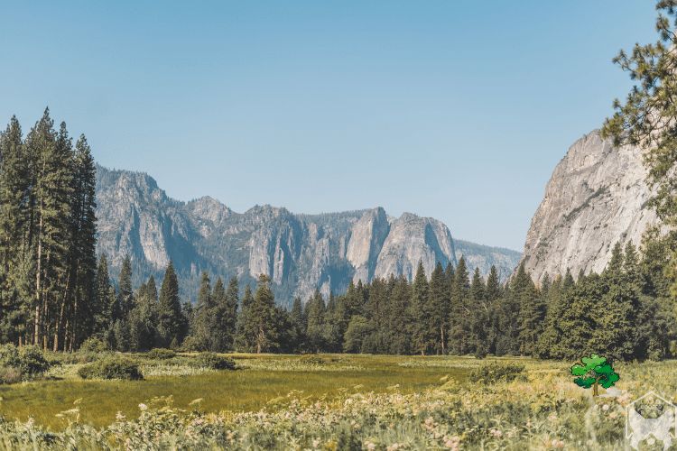
The trailhead is located near the south end of Wawona Meadow, where there are bathrooms and picnic tables. The first mile takes you through forest on a wide dirt and gravel road.
After about 1 mile, you’ll reach the meadow entrance gate and cross over the bridge into Wawona Meadows. From here you can continue on the loop trail or take the spur trail to see deer, bears, elk and more wildlife in their natural habitat.
If you want to continue on the loop trail, turn right at this point; otherwise continue straight ahead onto the spur trail until it meets back up with the loop at mile 2.8 (or just return back to your car).
As mentioned above, there are no major climbs during this hike so it’s perfect for those not looking for an intense workout but still want to enjoy nature. There are also some great photo opportunities along the way that are worth stopping for!
Yosemite Falls Trail
Distance: 7.2 miles round-trip
Elevation gain: 2,700 feet
The Yosemite Falls Trail is a challenging hike that rewards you with up-close views of the highest waterfall in North America, Yosemite Falls. The trail offers stunning views of the valley and Half Dome, making it a must-do hike for those visiting Yosemite Valley.
Starting from the Camp 4 trailhead, the Yosemite Falls Trail offers some of the most incredible views of Yosemite Valley and the park’s iconic waterfalls.
The best time to hike this trail is in spring when the water flow is at its peak. Nearby campgrounds, such as Upper Pines and Lower Pines, provide convenient access to the trailhead.
This 7.2-mile round-trip hike with an elevation gain of 2,700 feet might be challenging, but the mesmerizing views of Upper Yosemite Fall and the valley below make it well worth the effort.
Four Mile Trail
Distance: 9.6 miles round-trip
Elevation gain: 3,200 feet
The Four Mile Trail takes you from Yosemite Valley to Glacier Point, offering some of the most breathtaking views in the park.
This challenging hike is worth the effort, as you’ll be rewarded with panoramic views of Half Dome, El Capitan, and the valley below.
The Four Mile Trail begins at the base of Sentinel Rock and winds its way up to Glacier Point, offering breathtaking views of Yosemite Valley, El Capitan, and Half Dome.
The best time to experience this trail is during late spring through early fall.
The trailhead can be easily accessed from Yosemite Valley, and nearby campgrounds like Upper Pines and North Pines make for a great base to explore the area.
Although the hike is challenging, covering 9.6 miles round-trip and 3,200 feet of elevation gain, the panoramic vistas at Glacier Point are truly rewarding.
John Muir Trail
The John Muir Trail is a long-distance trail that stretches for 211 miles from Yosemite Valley to Mount Whitney.
While many people choose to hike the entire trail, you can also enjoy shorter sections within Yosemite National Park, such as the hike to Cathedral Lakes or the section between Tuolumne Meadows and Donohue Pass.
The John Muir Trail stretches over 200 miles from Yosemite Valley to Mount Whitney, but many hikers choose to explore shorter sections of the trail within the park. The trailhead at Happy Isles provides access to iconic sites such as Vernal and Nevada Falls.
The best time to hike the John Muir Trail is from June to September, when the snow has melted, and the high country is accessible.
The Upper Pines and Lower Pines campgrounds are ideal for launching your adventure on the John Muir Trail, where you’ll experience the park’s breathtaking wilderness.
Upper Yosemite Falls
Distance: 7.6 miles round-trip
Elevation gain: 2,600 feet
This challenging hike takes you up close to Upper Yosemite Falls, offering stunning views of the waterfall and the valley below.
The trail is steep and requires a good level of fitness, but the views are well worth the effort.
Upper Yosemite Falls Trail, starting from the Yosemite Valley Lodge area, takes hikers on a challenging 7.6-mile round-trip journey to the top of one of North America’s tallest waterfalls.
The best time to hike this trail is in spring and early summer when the waterfall is at its fullest. Nearby campgrounds, such as Upper Pines and North Pines, provide an excellent base for exploring the trail.
With an elevation gain of 2,600 feet, this strenuous hike rewards hikers with jaw-dropping views of Yosemite Valley and the surrounding granite cliffs.
Happy Isles to Nevada Fall
Distance: 5.4 miles round-trip
Elevation gain: 2,000 feet
This popular hike begins at Happy Isles and follows the Mist Trail to the top of Nevada Fall.
Along the way, you’ll pass Vernal Fall and enjoy stunning views of the surrounding granite cliffs and waterfalls.
Starting at the Happy Isles trailhead, this 5.4-mile round-trip hike takes visitors along the scenic Mist Trail to the powerful Nevada Fall. The best time to experience this trail is during the spring and early summer when the waterfalls are at their peak flow.
Campgrounds such as Upper Pines and Lower Pines are ideal for exploring this trail. Hikers will enjoy stunning views of Vernal Fall and Nevada Fall, as well as the lush greenery of Yosemite Valley.
El Capitan
Distance: 15 miles round-trip
Elevation gain: 3,500 feet
The hike to the top of El Capitan, one of Yosemite’s most iconic landmarks, is a challenging but rewarding adventure. The trail offers incredible views of the surrounding landscape, including Yosemite Valley, Half Dome, and the High Sierra.
To hike to the base of the iconic El Capitan, begin at the El Capitan Trailhead near the Bridalveil Creek Campground.
This 15-mile round-trip hike is best undertaken from late spring through early fall, when the weather is more predictable.
The Bridalveil Creek Campground provides a convenient base for exploring the trail.
Hikers will be rewarded with up-close views of El Capitan’s sheer granite face and the surrounding Yosemite Valley.
Dewey Point
Distance: 8 miles round-trip
Elevation gain: 1,400 feet
The Dewey Point trail provides a moderately challenging hike with spectacular views of Yosemite Valley and its iconic landmarks, such as El Capitan, Half Dome, and Cathedral Rocks.
The Dewey Point hike begins at the McGurk Meadow trailhead, located along Glacier Point Road. The best time to explore this trail is during the summer and early fall, when the meadows are in full bloom.
The Bridalveil Creek Campground is a nearby option for accommodations.
This moderate 8-mile round-trip hike takes visitors through lush meadows and forests, culminating in panoramic views of Yosemite Valley, El Capitan, and Half Dome from Dewey Point.
Illilouette Fall
Distance: 5 miles round-trip
Elevation gain: 600 feet
This relatively easy hike takes you through beautiful forests and meadows to the base of Illilouette Fall, a lesser-known but equally stunning waterfall in Yosemite Valley.
Starting from the Glacier Point Trailhead, the hike to Illilouette Fall is best enjoyed in spring and early summer when the waterfall is at its fullest. This 5-mile round-trip hike is moderately challenging and takes hikers through beautiful forests and past cascading streams.
The Bridalveil Creek Campground is a convenient base for exploring this trail.
Hikers will be rewarded with stunning views of Illilouette Fall, Half Dome, and the surrounding Yosemite landscapes.
Best Short Hiking Trails in Yosemite National PArk
For those with limited time or seeking a less strenuous adventure, Yosemite National Park boasts a selection of short hikes that pack a punch in terms of scenery and natural wonders. These trails offer a condensed, yet unforgettable, hiking experience, taking you to some of the park’s most remarkable attractions within a shorter distance.
Taft Point
Distance: 2.2 miles round-trip
Elevation gain: 250 feet
Taft Point is a stunning viewpoint that offers expansive vistas of Yosemite Valley, including El Capitan and Yosemite Falls. This relatively easy hike is perfect for those looking for a short adventure with a rewarding payoff.
The Taft Point trail begins along Glacier Point Road and is best explored during late spring through early fall. This 2.2-mile round-trip hike is relatively easy and offers breathtaking views of Yosemite Valley and El Capitan.
The nearby Bridalveil Creek Campground provides a great base for exploring the area. The highlight of the hike is standing on the edge of Taft Point, taking in the expansive views of the valley below.
Lower Mariposa Grove
Distance: 2.2 miles round-trip
Elevation gain: 500 feet
A shorter alternative to the full Mariposa Grove hike, the Lower Mariposa Grove trail takes you through a beautiful sequoia forest, featuring the Fallen Monarch and Bachelor and Three Graces trees.
Begin your hike to Lower Mariposa Grove at the Mariposa Grove Welcome Plaza. The best time to visit is from late spring through early fall, when the grove is most accessible.
The nearby Wawona Campground is an ideal base for exploring this trail.
This 2.2-mile round-trip hike is easy and takes visitors through the enchanting Lower Mariposa Grove, home to over 500 mature giant sequoias, including the iconic Grizzly Giant and California Tunnel Tree.
Chilnualna Falls
Distance: 8.2 miles round-trip
Elevation gain: 600 feet
This trail offers a beautiful hike through a forested area to the base of Chilnualna Falls, a multi-tiered waterfall that’s particularly stunning in the spring and early summer.
The Chilnualna Falls Trail starts near the Wawona area of Yosemite National Park. This moderately difficult 8.2-mile round-trip hike is best experienced from late spring through early fall.
The Wawona Campground is conveniently located near the trailhead. The trail takes hikers through lush forests and along Chilnualna Creek, leading to the stunning, multi-tiered Chilnualna Falls.
May Lake
Distance: 2.5 miles round-trip
Elevation gain: 485 feet
This hike leads to May Lake, a picturesque alpine lake at the base of Mount Hoffmann. The trail offers beautiful views of the surrounding mountains and is a great spot for a refreshing swim in the summer months.
The Chilnualna Falls Trail starts near the Wawona area of Yosemite National Park. This moderately difficult 8.2-mile round-trip hike is best experienced from late spring through early fall.
The Wawona Campground is conveniently located near the trailhead. The trail takes hikers through lush forests and along Chilnualna Creek, leading to the stunning, multi-tiered Chilnualna Falls.
Indian Rock Arch
Distance: 4.8 miles round-trip
Elevation gain: 1,300 feet
Indian Rock Arch is a remarkable geological feature, as it is the only natural granite arch in Yosemite National Park. This moderately challenging hike takes you on a scenic journey through lush forests, culminating at the distinctive arch.
Throughout the hike, you’ll be rewarded with stunning views of the park’s diverse landscapes.
Starting at the Porcupine Creek Trailhead along Tioga Road, the hike to Indian Rock Arch is best experienced during the summer and early fall months.
The 4.8-mile round-trip hike is moderately challenging and takes visitors through lush forests to the only natural granite arch in Yosemite National Park. The nearby Tuolumne Meadows Campground is an ideal base for exploring this unique trail.
Best Easy Hiking Trails in Yosemite National Park
Yosemite National Park offers an array of easy hikes that cater to visitors of all ages and fitness levels. These trails provide a perfect introduction to the park’s natural beauty, combining accessible routes with breathtaking views of iconic landmarks, lush forests, and pristine meadows.
Bridalveil Fall Trail
Distance: 1.2 miles round-trip
Elevation gain: 200 feet
This short and easy hike leads to the base of Bridalveil Fall, one of Yosemite’s most famous waterfalls. The trail is suitable for all ages and skill levels, making it a popular choice for families visiting the park.
Lower Yosemite Fall Loop
Distance: 1-mile round-trip
Elevation gain: Minimal
The Lower Yosemite Fall Loop is a paved, wheelchair-accessible trail that takes you to the base of the lower section of Yosemite Falls. This easy hike is perfect for families with young children or anyone looking for a leisurely stroll with beautiful views.
The Lower Yosemite Fall Loop starts near Yosemite Village and is accessible year-round, but the best time to visit is during spring and early summer when the waterfall is at its peak flow.
This easy 1-mile round-trip hike offers stunning views of the iconic Lower Yosemite Fall. Nearby campgrounds, such as Upper Pines and Lower Pines, provide convenient access to the trailhead.
Glacier Point Trail
Distance: 9.6 mile round-trip
Elevation gain: 3200 ft
This short, wheelchair-accessible trail leads to Glacier Point, an incredible viewpoint that offers panoramic views of Yosemite Valley, Half Dome, and the High Sierra. The trail is suitable for all ages and skill levels.
The Glacier Point Trail, also known as the Four Mile Trail, starts at the base of Sentinel Rock and leads to Glacier Point. The best time to hike this trail is from late spring through early fall.
The trailhead can be accessed from Yosemite Valley, and campgrounds like Upper Pines and North Pines provide convenient accommodations.
Covering 9.6 miles round-trip with 3,200 feet of elevation gain, this challenging hike rewards visitors with panoramic views of Yosemite Valley, El Capitan, and Half Dome.
Cook’s Meadow Loop
Distance: 1 mile round-trip
Elevation gain: Minimal
The Cook’s Meadow Loop is a flat, easy walk that offers stunning views of Yosemite Valley, including Half Dome, Yosemite Falls, and Glacier Point.
The trail is wheelchair accessible and perfect for a leisurely stroll or a family outing.
The Cook’s Meadow Loop is an easy, 1-mile round-trip hike that starts near Yosemite Valley Lodge. Accessible year-round, the best time to visit is during the spring when the meadows are lush and the waterfalls are flowing.
Nearby campgrounds such as Upper Pines and Lower Pines provide convenient access to the trailhead.
This leisurely hike offers picturesque views of Yosemite Falls, Half Dome, and the surrounding meadows.
Valley Loop Trail
Distance: 20.4 miles round-trip
Elevation gain: 400 feet
The Valley Loop Trail is a 20.4-mile loop near Yosemite Valley, California.
This easy route, popular among hikers, snowshoers, and runners, takes an average of 7 hours to complete. Open year-round, it offers a beautiful experience during any season.
The Valley Loop Trail is a relatively easy and mostly flat hike that offers an opportunity to explore the beauty of Yosemite Valley at a leisurely pace.
The trail passes by many of the park’s iconic landmarks, such as El Capitan, Half Dome, and Yosemite Falls.
The Valley Loop Trail, a 20.4-mile loop near Yosemite Valley, California, is accessible year-round but is best enjoyed from late spring through early fall when the weather is pleasant.
The trail can be accessed from various points within Yosemite Valley, and nearby campgrounds like Upper Pines and North Pines offer convenient accommodations.
This mostly flat trail takes hikers past iconic landmarks such as El Capitan, Half Dome, and Yosemite Falls, providing a comprehensive tour of Yosemite Valley’s scenic landscapes.
Yosemite Valley to Wapama Fall
Distance: 13 miles round-trip
Elevation gain: 200 feet
This easy hike takes you along the edge of Hetch Hetchy Reservoir to the base of Wapama Fall, a beautiful waterfall that is especially impressive during the spring runoff.
The trail from Yosemite Valley to Wapama Fall starts at the O’Shaughnessy Dam trailhead in Hetch Hetchy Valley. Best experienced during spring and early summer when waterfalls are at their peak, this 13-mile round-trip hike is moderately challenging.
The nearby Hodgdon Meadow Campground provides a convenient base for exploring this trail. Hikers will be treated to magnificent views of Wapama Fall and the surrounding granite cliffs.
Tuolumne Grove of Giant Sequoias
Distance: 2.5 miles round-trip
Elevation gain: 500 feet
This easy hike takes you through a peaceful grove of giant sequoias, including the massive Tunnel Tree and several other impressive specimens.
Beginning at the Tuolumne Grove parking area along Tioga Road, the hike to Tuolumne Grove of Giant Sequoias is best enjoyed from late spring through early fall. This 2.5-mile round-trip hike is relatively easy, taking visitors through a peaceful grove of giant sequoias.
The nearby Crane Flat Campground offers a convenient base for exploring this trail. Hikers can marvel at the ancient trees and even walk through the tunnel of the Dead Giant sequoia.
Gaylor Lakes
Distance: 3.5 miles round-trip
Elevation gain: 500 feet
The Gaylor Lakes trail offers a short, relatively easy hike to a series of beautiful alpine lakes in the high country of Yosemite National Park.
The trail features stunning views of the surrounding mountains and meadows.
The Gaylor Lakes trail starts at the Tioga Pass entrance station, and it’s best to visit during the summer and early fall when Tioga Road is open. This 3.5-mile round-trip hike is moderately challenging, taking hikers through alpine meadows and past several picturesque lakes.
The nearby Tuolumne Meadows Campground provides a convenient base for exploring this trail. The hike offers spectacular views of the High Sierra and the surrounding Gaylor Lakes Basin.
Olmsted Point
Distance: 0.5 miles round-trip
Elevation gain: Minimal
This short, easy hike leads to Olmsted Point, a fantastic viewpoint offering panoramic views of Tenaya Lake, Clouds Rest, and Half Dome.
The trail is suitable for all ages and skill levels, making it a great option for a quick stop during a scenic drive.
The Olmsted Point trail starts at the parking area along Tioga Road and is best experienced during the summer and early fall when the road is open. This easy, 0.5-mile round-trip hike offers stunning views of Tenaya Lake, Clouds Rest, and the backside of Half Dome.
The nearby Tuolumne Meadows Campground is an ideal base for exploring this trail. The hike provides a unique perspective on Yosemite’s iconic granite landscapes.
Merced Grove
Distance: 3 miles round-trip
Elevation gain: 600 feet
This relatively easy hike takes you through a peaceful and secluded grove of giant sequoias.
The trail is less crowded than the Mariposa Grove, making it a great option for those seeking a quiet and serene experience among the ancient trees.
The Merced Grove Trail starts at the parking area off of Big Oak Flat Road and is best visited from late spring through early fall.
This 3-mile round-trip hike is moderately challenging, leading visitors through a serene grove of giant sequoias. The nearby Hodgdon Meadow Campground offers a convenient base for exploring this trail.
Hikers can enjoy the tranquility of the grove while admiring the ancient trees.
Best Fall Hiking Trails in Yosemite
Autumn in Yosemite National Park brings a magical transformation, as the foliage bursts into vibrant shades of gold, orange, and red. The best fall hikes in Yosemite showcase the park’s stunning landscapes draped in these brilliant hues, offering unforgettable experiences for hikers seeking to explore the park during this captivating season.
Tuolumne Meadows and Soda Springs
Distance: 2.8 miles round-trip
Elevation gain: 200 feet
This easy hike takes you through the breathtaking Tuolumne Meadows, with its golden meadows and shimmering Soda Springs.
Fall is an ideal time to experience the beauty of this high-country landscape without the summer crowds.
Lembert Dome
Distance: 2.8 miles round-trip
Elevation gain: 850 feet
Lembert Dome is a granite monolith that offers panoramic views of Tuolumne Meadows and the surrounding High Sierra.
The hike is moderately challenging but rewards you with stunning fall colors and unforgettable vistas.
The Lembert Dome trail starts at the Lembert Dome parking area along Tioga Road and is best explored during the summer and early fall when the high country is accessible.
This 2.8-mile round-trip hike is moderately challenging, taking hikers up to the granite summit of Lembert Dome. The nearby Tuolumne Meadows Campground provides a convenient base for exploring this trail.
From the summit, hikers are rewarded with panoramic views of Tuolumne Meadows, the Cathedral Range, and the surrounding High Sierra.
North Dome
Distance: 9.4 miles round-trip
Elevation gain: 1,900 feet
This moderately challenging hike takes you to North Dome, which offers one of the best views of Half Dome in the park.
The trail passes through beautiful forests and meadows, which display their vibrant fall colors in the autumn months.
The North Dome trail begins at the Porcupine Creek Trailhead along Tioga Road and is best experienced during the summer and early fall when the high country is accessible.
This 9.4-mile round-trip hike is moderately challenging, taking hikers to the summit of North Dome, which offers unparalleled views of Half Dome and Yosemite Valley.
The nearby Tuolumne Meadows Campground is an ideal base for exploring this trail. The hike passes through forests and meadows before reaching the granite summit, providing a variety of scenic landscapes to enjoy.
Tenaya Lake
Distance: 2.5 miles round-trip
Elevation gain: Minimal
This easy hike around Tenaya Lake offers stunning views of the surrounding granite peaks and colorful fall foliage. The trail is mostly flat, making it suitable for all ages and skill levels.
The Tenaya Lake trail, accessible from the parking area along Tioga Road, is best enjoyed during the summer and early fall when the high country is open.
This easy, 2.5-mile round-trip hike takes visitors around the serene alpine lake, offering stunning views of the surrounding granite peaks.
The nearby Tuolumne Meadows Campground provides a convenient base for exploring this trail. Hikers can enjoy a leisurely stroll along the lakeshore or take a refreshing dip in the crystal-clear waters.
Dog Lake
Distance: 3.6 miles round-trip
Elevation gain: 600 feet
The hike to Dog Lake is a moderately challenging trail that takes you through beautiful forests and meadows to a serene alpine lake.
The fall colors make this hike a popular choice during the autumn season.
The Dog Lake trail begins at the Lembert Dome parking area along Tioga Road and is best explored during the summer and early fall when the high country is accessible.
This 3.6-mile round-trip hike is relatively easy and takes hikers through forests and meadows to the peaceful Dog Lake. The nearby Tuolumne Meadows Campground offers a convenient base for exploring this trail.
The hike provides lovely views of the lake and the surrounding High Sierra.
Parker Pass
Distance: 8.8 miles round-trip
Elevation gain: 1,600 feet
Parker Pass is a moderately difficult hike that takes you through meadows and alpine terrain, offering views of Mono Lake, Mount Gibbs, and the Kuna Crest.
The trail is particularly stunning in the fall, with vibrant colors and fewer crowds.
The Parker Pass trail starts at the Mono Pass Trailhead along Tioga Road and is best experienced during the summer and early fall when the high country is accessible.
This 8.8-mile round-trip hike is moderately challenging, taking hikers through alpine meadows and past glacial lakes to the 11,100-foot Parker Pass.
The nearby Tuolumne Meadows Campground is an ideal base for exploring this trail. The hike offers spectacular views of the High Sierra, including the Kuna Crest and the surrounding wilderness.
Young Lakes
Distance: 14 miles round-trip
Elevation gain: 1,600 feet
The Young Lakes hike takes you through forests, meadows, and alpine landscapes to a series of picturesque alpine lakes.
The fall colors and crisp air make this hike a favorite among visitors during the autumn months.
The Young Lakes trail begins at the Dog Lake/Young Lakes Trailhead along Tioga Road and is best enjoyed during the summer and early fall when the high country is open.
This 14-mile round-trip hike is moderately challenging, taking hikers through forests, meadows, and past several pristine alpine lakes. The nearby Tuolumne Meadows Campground provides a convenient base for exploring this trail.
The hike offers stunning views of the surrounding peaks, including Ragged Peak and Mount Conness.
Lyell Canyon
Distance: 24 miles round-trip
Elevation gain: 200-800 feet
This relatively easy hike takes you through the stunning Lyell Canyon, with its vibrant meadows, towering granite cliffs, and sparkling streams.
Fall is a great time to enjoy the beauty of this trail without the summer crowds, as the colorful foliage creates a breathtaking backdrop.
The Lyell Canyon trail starts at the Tuolumne Meadows Wilderness Center and is best experienced during the summer and early fall when the high country is accessible.
This 24-mile round-trip hike is moderately challenging, taking hikers through the scenic Lyell Canyon along the John Muir Trail.
The nearby Tuolumne Meadows Campground is an ideal base for exploring this trail. The hike follows the Lyell Fork of the Tuolumne River, providing picturesque views of the canyon and the surrounding High Sierra.
Clouds Rest
Distance: 14.5 miles round-trip
Elevation gain: 3,100 feet
Clouds Rest is a challenging hike that offers some of the most stunning views in Yosemite National Park.
The trail takes you through forests and meadows before climbing to the summit, where you’ll be rewarded with panoramic vistas of Half Dome, Yosemite Valley, and the High Sierra.
The fall colors and cooler temperatures make this hike a popular choice during the autumn season.
The Clouds Rest trail begins at the Sunrise Lakes Trailhead along Tioga Road and is best enjoyed during the summer and early fall when the high country is accessible.
This 14.5-mile round-trip hike is challenging, taking hikers up to the 9,926-foot summit of Clouds Rest. The nearby Tuolumne Meadows Campground provides a convenient base for exploring this trail.
The hike passes through forests, meadows, and alpine terrain before reaching the summit, which offers breathtaking 360-degree views of Yosemite Valley, Half Dome, and the surrounding High Sierra.
Conclusion
If you really want to experience the beauty of Yosemite, you have to hike some of its trails. Yosemite National Park has a wide variety of trails that cater to every type of hiker.
Yosemite National Park is a hiker’s paradise, offering trails that cater to every skill level and interest.
From short hikes to iconic landmarks, to challenging adventures that reward you with breathtaking views, there’s something for everyone in this spectacular park.
No matter which trail you choose, always remember to respect the park’s rules, practice Leave No Trace principles, and enjoy the unforgettable beauty of Yosemite.
