Explore 9 top hiking trails in Death Valley National Park! Dive into mesmerizing landscapes, from salt flats to peaks. Ready for the adventure?
Got your hiking boots ready? Death Valley National Park is calling! Dive into a land of stunning contrasts, from eerie salt flats to majestic peaks.
With 9 top-notch trails highlighted, we’ll guide you through every mesmerizing twist and turn. Whether you’re chasing adrenaline-packed adventures or peaceful nature walks, there’s something here for every hiker.
So, let’s jump in, discover the must-see spots, and get those boots dusty! Ready, set, hike!
Darwin Falls
In the far northwestern corner of Death Valley National Park, near the community of Panamint Springs, is Darwin Falls. This 18-foot waterfall is one of the only permanent waterfalls in the park, and it’s a striking contrast to the barren landscape around it.
The water at the base of Darwin Falls is fed by a small stream that originates in the hills above the falls. This is part of an ancient aquifer and provides a much-needed source of fresh water for wildlife and humans alike. Along with groundwater, the stream also carries minerals which have created colorful travertine deposits along the base of the falls.
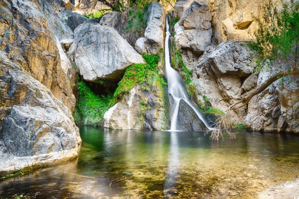
The surrounding environment is populated with a wide variety of plant life, including Joshua trees, junipers, scrub oaks and cactus species such as prickly pear, cholla and barrel cactus.
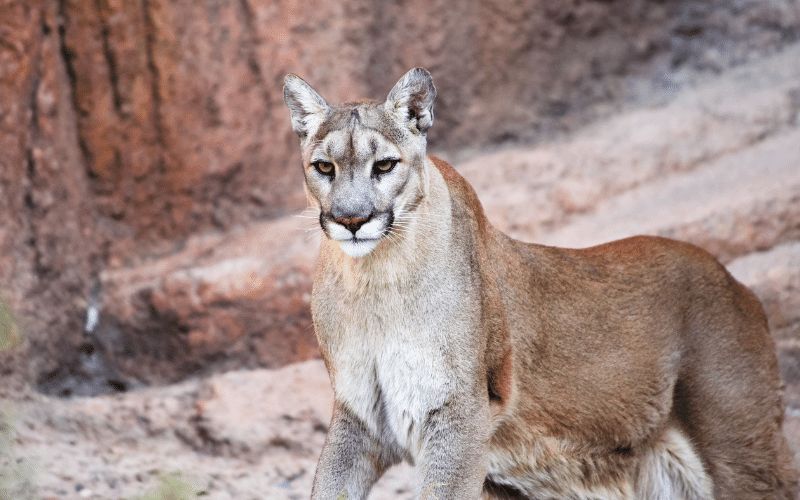
The area is also home to numerous bird species including ravens, hawks and owls. Mammals like coyotes, big horn sheep and even mountain lions can also be found in the area.
Whether you visit Death Valley in summer or winter, make sure to stop by Darwin Falls for some spectacular scenery and a peaceful respite from your travels!
Badwater Basin Salt Flats Trail
Death Valley National Park is home to some of the most spectacular hiking trails in the United States. One of the most popular trails is the Badwater Basin Salt Flats Trail. The trailhead is located at Badwater Basin, which is the lowest point in North America.
From there, the trail winds its way through a stunning landscape of white salt flats and rugged mountains. The views from the trail are simply breathtaking.
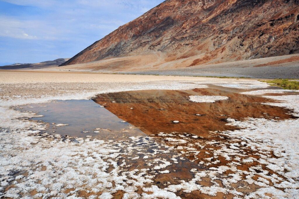
The Badwater Basin Salt Flats Trail is a moderate hike that can be completed in a day. However, I would recommend taking your time and spending a few days exploring all that Death Valley National Park has to offer.
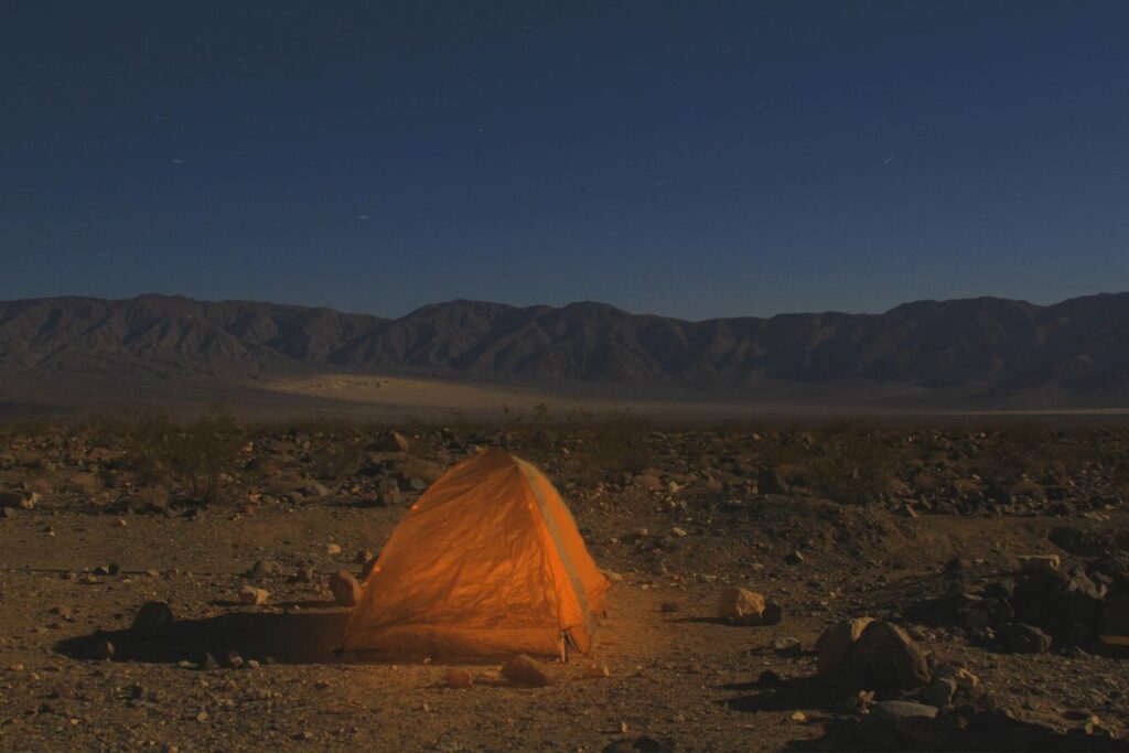
There are plenty of camping sites along the trail where you can set up your tent and enjoy the incredible views. Trust me, you won’t regret it!
Explore this 3.1-km out-and-back trail near Death Valley, California. Generally considered an easy route, it takes an average of 33 min to complete.
The trail features splendid views of the Badwater Basin Salt Flats, and other majestic rock formations towered in the backdrop. Explore a diverse landscape of salt flats and rugged mountains. Make your way along the rocky path, and take in the unique beauty of this extraordinary area.
You may catch glimpses of shadows cast by dust devils and wildflowers adding color to the whiteness of the salt flats on a clear day. As you progress through, you will ascend gradually as you reach higher elevations.
Rest up at troughs carved out of rocks with inviting shade for some cool respite or just relish the unparalleled peace among nature’s grandeur. Your journey through this surreal landscape eventually leads you back to your starting point.
Mosaic Canyon Trail
The Mosaic Canyon Trail is one of the most popular hikes in Death Valley National Park. The trailhead is located near the entrance to the park, and the trail itself is an easy hike with a moderate elevation gain.
The 4-mile trail follows Mosaic Canyon for about two miles before reaching a beautiful waterfall. The waterfall is one of the highlights of the hike, and it’s a great place to take a break and enjoy the scenery. After enjoying the waterfall, hikers can continue on to explore more of Mosaic Canyon or turn around and head back to the trailhead.
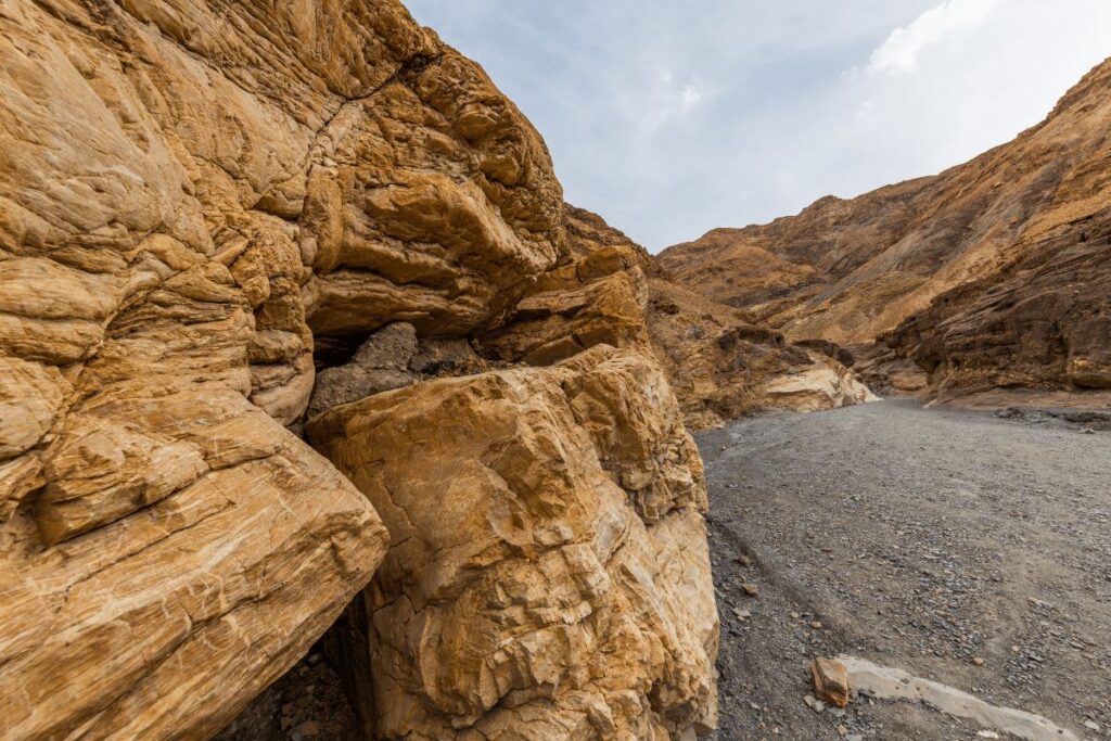
The trail is mostly rocky, with some sandy sections and some loose gravel areas. The first two miles are relatively flat with only a few hills to climb. After the waterfall, the trail becomes more difficult, with a steep ascent followed by an equally steep descent.
This section can be difficult to navigate, especially during inclement weather, so extra caution should be taken.
The Mosaic Canyon Trail is an enjoyable hike that offers stunning views of beautiful scenery along the way. It’s best to start early in the day as temperatures can become very hot during the summer months.
Appropriate footwear and plenty of water should be brought on this hike as well as any other hikes in Death Valley National Park.
Natural Bridge Trail
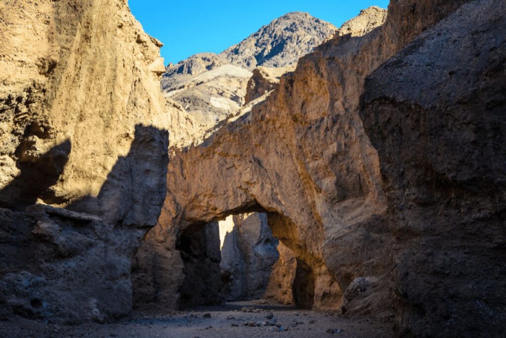
The Natural Bridge Trail is a short but strenuous hike that leads to one of the most popular landmarks in Death Valley National Park, the Natural Bridge.
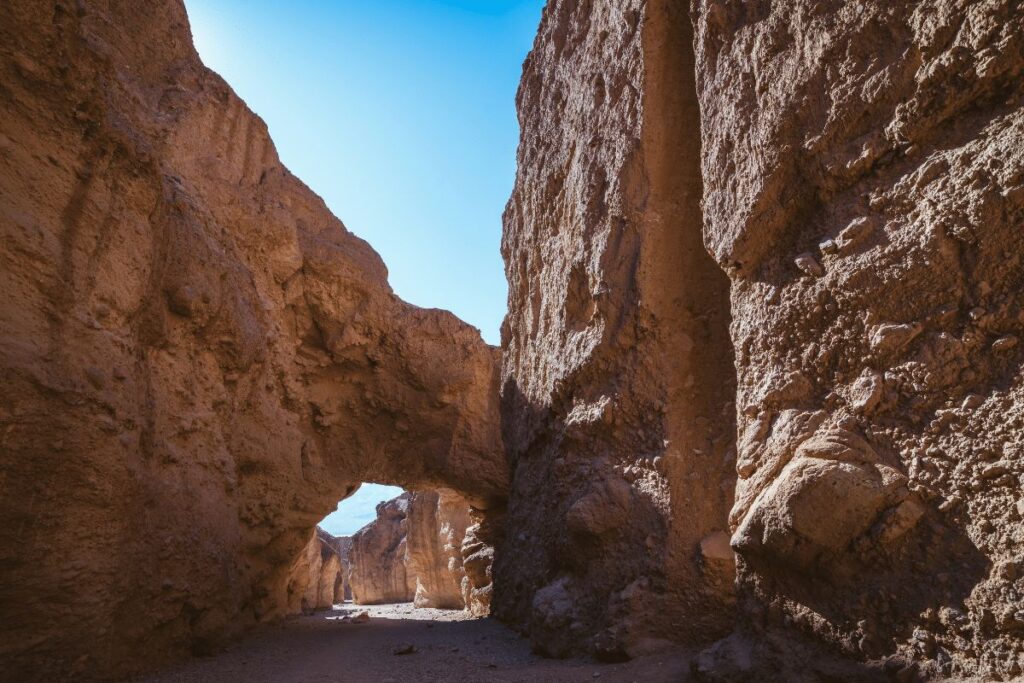
The trail begins from the Natural Bridge Trailhead and is a one-mile round trip, making it ideal for all experience levels. As you navigate the path along the rocky wash, enjoy views of the stunning terrain synonymous with Death Valley.
The highlight of the hike is undoubtedly reaching the Natural Bridge itself: an arch shaped by millions of years of erosion and carved into limestone rock, standing impressively at 30 feet tall and spanning 25 feet across. Along your hike there are also plenty of opportunities to enjoy some wildlife- including desert bighorn sheep– if you’re lucky enough to spot them!
When you reach the destination, take in this inspiring sight before returning along the same route. This easy yet memorable hike around Natural Bridge proves that not all hikes have to be long and grueling in order to be worthwhile—and is a great way for anyone to experience the beauty of Death Valley National Park!
Zabriskie Point
Death Valley National Park is home to some of the most spectacular hiking trails in the country. Zabriskie Point is one of the most popular trails in the park, and for good reason.
The trailhead is located just a short drive from the visitors center, and the views from the top are absolutely breathtaking. The trail itself is fairly easy to follow and is well-marked, making it a great option for hikers of all experience levels.
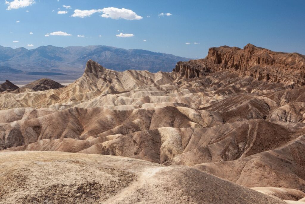
This stunning natural wonder, located in the heart of Death Valley National Park, promises to leave you in awe of its otherworldly beauty.
As you make your way to the viewpoint, you’ll be treated to stunning panoramic views of the surrounding landscape. But the real excitement starts when you arrive at Zabriskie Point itself. With its dramatic, jagged rock formations and vibrant hues of red, orange, and gold, this is a sight that simply can’t be missed.
But the fun doesn’t stop there! Take a hike along one of the nearby trails and immerse yourself in the stunning natural surroundings. Marvel at the unique geology of the area and keep your eyes peeled for desert wildlife.
Whether you’re a seasoned adventurer or just looking for a fun day out with the family, Zabriskie Point Scenic Viewpoint is a must-see destination. So what are you waiting for? Come experience the excitement and wonder of this truly breathtaking natural wonder!
Ibex Dunes Hike
The Ibex Dunes Hike is one of the most spectacular hiking trails in Death Valley National Park. The trailhead is located at the south end of the park, near the town of Furnace Creek.
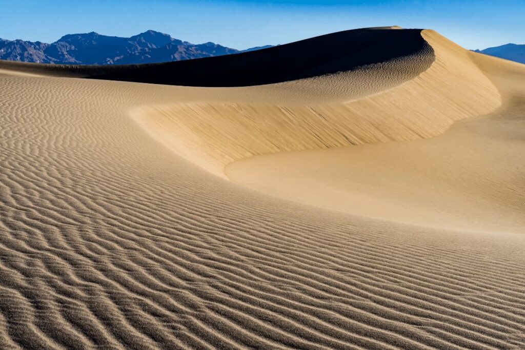
From the trailhead, the hike winds its way through a canyon between two massive sand dunes. The views from the trail are simply stunning, and the level of difficulty is moderate. The hike can be done as a day hike or an overnight backpack trip.
This 3.5-mile out-and-back hike takes you through some of the most stunning scenery in the park, including sand dunes, Joshua trees, and spectacular views of the valley below.
The trailhead for this hike is located at Stovepipe Wells Village, and the hike itself is relatively easy, making it a great option for those looking for a relatively easy day hike.
Ubehebe and Little Hebe Craters
This scenic hike is a fun and interactive way to experience the raw power of volcanic activity and the breathtaking beauty of the desert landscape.
The Ubehebe and Little Hebe Craters are two of the most prominent features in the northern part of the park. They are both volcanic craters formed by explosive eruptions, which occurred thousands of years ago.
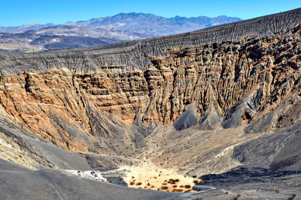
The Ubehebe Crater is the largest and most well-known, measuring about half a mile across and 600 feet deep. The smaller Little Hebe Crater is located nearby and is connected to Ubehebe by a scenic hiking trail.
The Ubehebe and Little Hebe Crater Trail is a moderate 1.5-mile hike that takes you right to the edge of these awe-inspiring natural wonders. As you make your way along the trail, you’ll be treated to stunning panoramic views of the surrounding landscape, with colorful rock formations and desert flora and fauna all around you.
But the real excitement starts when you arrive at the craters themselves. Stand at the edge of the massive Ubehebe Crater and feel the power of the volcanic forces that created it. Or take a stroll along the rim of the Little Hebe Crater and marvel at its intricate formations and stunning colors.
For an even more interactive experience, consider bringing along a geology field guide or a book about the history of volcanic activity in the area. These resources can help you better understand the unique geological processes that created these fascinating craters.
The Ubehebe and Little Hebe Crater Trail is a fun and interactive way to experience the beauty and power of Death Valley National Park. So grab your hiking boots and get ready to explore!
Cottonwood mountains
The Cottonwood-Marble Loop is a spectacular 28-mile hike in Death Valley National Park that takes you through some of the park’s most breathtaking and diverse landscapes. This challenging but rewarding trail offers the opportunity to experience stunning vistas, towering mountains, and vibrant wildflowers, all while immersing yourself in the park’s rich natural and cultural history.
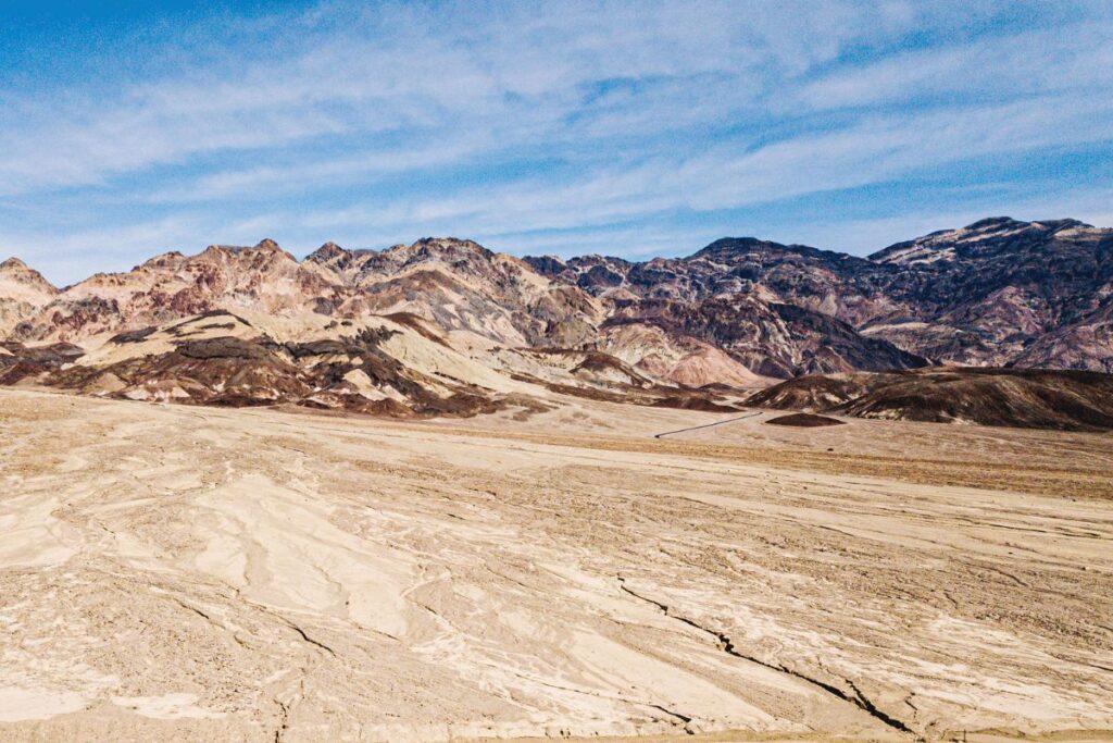
The trail begins at the Cottonwood Visitor Center and follows a well-marked path through a picturesque desert valley, with views of the Cottonwood Mountains rising up on either side. As you hike, keep an eye out for the abundant wildlife that call this area home, including bighorn sheep, coyotes, and various species of birds.
After several miles, the trail begins to climb into the mountains, offering increasingly panoramic views of the surrounding landscape. You’ll pass through canyons, over ridges, and along high plateaus, with opportunities to stop and rest at scenic overlooks along the way.
One of the highlights of the Cottonwood-Marble Loop is the stunning Marble Canyon, a narrow gorge with walls that rise up to 300 feet on either side. As you make your way through the canyon, take in the breathtaking scenery and keep an eye out for the unique rock formations that line the canyon walls.
Another notable feature of the trail is the historic remnants of the mining town of Chloride City, which you’ll pass through on the way back to the Cottonwood Visitor Center. These ruins offer a fascinating glimpse into the park’s past, and provide a stark contrast to the natural beauty that surrounds them.
The Cottonwood Campground, located near the trailhead, offers 62 sites with water and flush toilets, as well as picnic tables and fire pits. The nearby Stovepipe Wells Campground and Furnace Creek Campground also offer similar amenities.
It’s important to note that water sources along the trail are extremely limited, so it’s essential to bring plenty of your own water. The only reliable water source on the trail is at the Cottonwood Springs Ranger Station, located about 2.5 miles from the trailhead. However, this water is not treated and should be filtered or treated before drinking.
In addition to bringing your own water, it’s important to be prepared for the extreme desert conditions of Death Valley. Temperatures can be dangerously high, so it’s essential to pack plenty of sunscreen, hats, and light-colored clothing to protect yourself from the sun. It’s also important to carry a map and plenty of food and snacks to fuel your hike.
As with all activities in national parks, there are regulations that visitors must follow while hiking the Cottonwood-Marble Loop.
These regulations include staying on designated trails, packing out all trash and waste, and respecting the natural environment and cultural resources of the park.
It’s important to educate yourself on these regulations before your hike and to follow them carefully to help preserve the park for future generations.
Titus Canyon
Titus Canyon is one of the most popular hiking trails in Death Valley National Park. The trailhead is located at the end of Titus Canyon Road, about 27 miles from Death Valley Junction.
Titus Canyon is a stunning natural wonder located in Death Valley National Park. This narrow canyon is a popular destination for visitors who want to experience the park’s rugged terrain, unique geology, and rich history.
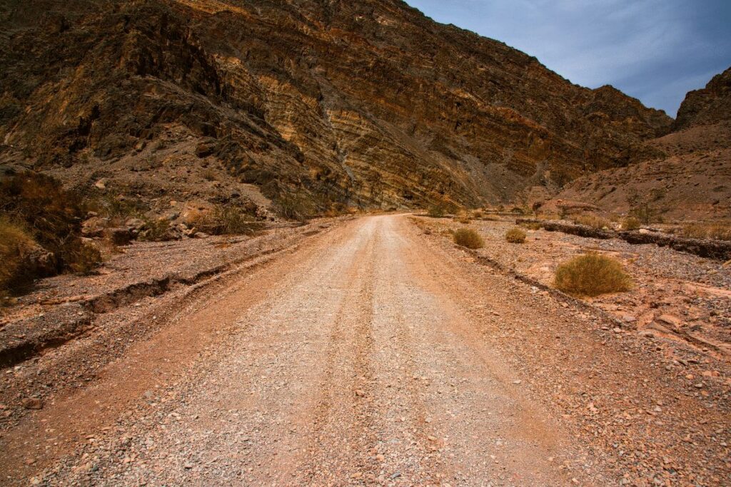
The canyon is accessible by a one-way dirt road that winds through the rugged desert landscape, providing stunning views along the way.
One of the most notable features of Titus Canyon is its towering walls, which rise up to 500 feet on either side of the canyon floor. As you hike or drive through the canyon, you’ll be treated to breathtaking views of these towering rock formations, which have been carved by millions of years of erosion.
In addition to its natural beauty, Titus Canyon is also home to a wealth of cultural and historical artifacts. The canyon was once home to several Native American tribes, and there are numerous petroglyphs and other rock art that can be seen along the canyon walls.
The canyon was also an important mining area during the late 1800s and early 1900s, and you can still see the remnants of old mines and ghost towns as you explore the canyon.
Hiking through Titus Canyon is a popular activity for visitors to Death Valley National Park. The canyon offers several hiking trails that range in difficulty from easy to challenging, so there’s something for hikers of all skill levels.
Some of the most popular hikes in the canyon include the 2.5-mile round trip hike to the Leadfield ghost town, and the more challenging 6-mile round trip hike to Red Pass, which offers stunning views of the surrounding landscape.
If you prefer to drive through the canyon, the one-way dirt road is accessible by high-clearance vehicles and offers a thrilling and scenic drive through some of the park’s most rugged terrain.
The road is typically open from late fall through early spring, but it’s important to check with the park before driving to ensure that the road is open and safe to drive.
Whether you choose to hike or drive through Titus Canyon, it’s an experience that you won’t soon forget. With its stunning natural beauty, rich history, and rugged terrain, Titus Canyon is a must-see destination for anyone visiting Death Valley National Park.
Conclusion
Death Valley National Park is a place of great natural beauty, filled with some truly spectacular hiking trails for nature lovers to explore. Whether you are looking for a peaceful stroll down an ancient canyon or a more thrilling adventure up the top of a mountain,
Death Valley has something that will appeal to everyone’s tastes and level of experience. If you want to discover the wonders offered by this stunning national park then make sure to check out these nine spectacular hiking trails in Death Valley National Park!

