Explore top 7 hiking trails in Saguaro National Park and meet the wild locals on your journey!
Are you yearning for an adventure in the great outdoors? Do you want to witness nature’s beauty at its finest? Look no further than Saguaro National Park, home to some of the most breathtaking hiking trails in the United States.
From scenic vistas to towering cacti, each trail offers something unique and captivating. So pack your bags, lace up your boots, and get ready to explore the top 7 hiking trails in Saguaro National Park. Get lost in nature’s splendor and let it rejuvenate your soul on this unforgettable journey.
Mica View Trail (2-mile)
The Mica View Trail is a 2-mile loop hike located in the northwest section of the Rincon Mountains district of Saguaro National Park, Arizona. The trailhead is at the Mica View picnic area and can be accessed by a smooth, one-mile dirt road branching off the one-way Cactus Forest Drive.

The Mica View Trail is rated as an easy hike and is suitable for beginners. The trail traverses mostly open terrain with saguaro cacti, bushes, and palo verde trees. Hikers can enjoy views of the Santa Catalina Mountains and other surrounding mountain ranges.
After a short segment of the Shantz Trail eastwards, the loop continues south along the Cactus Forest Trail through similarly flat surroundings. The trail crosses two shallow washes and descends slightly to the larger Javelina Wash, surrounded by mesquite trees and bushes but no cacti.
The Mica View Trail is open year-round, with the best time to hike being from fall to spring. The trail is used moderately to highly and is a popular exercise route for local residents. Dogs are permitted on the trail, but must be kept on a leash.
Hikers are advised to bring plenty of water, wear sunscreen and appropriate footwear, and be aware of the potential for desert hazards, such as rattlesnakes. The Mica View Trail offers a short and easy hiking experience that showcases the beautiful Sonoran Desert scenery of Saguaro National Park.
Bridal Wreath Falls Trail (5.5 miles)
Bridal Wreath Falls Trail is a must-do hike for those visiting the Rincon Mountain District of Saguaro National Park. This moderately difficult trail offers stunning views of the city of Tucson, occasional wildlife sightings, and a beautiful waterfall at the end.
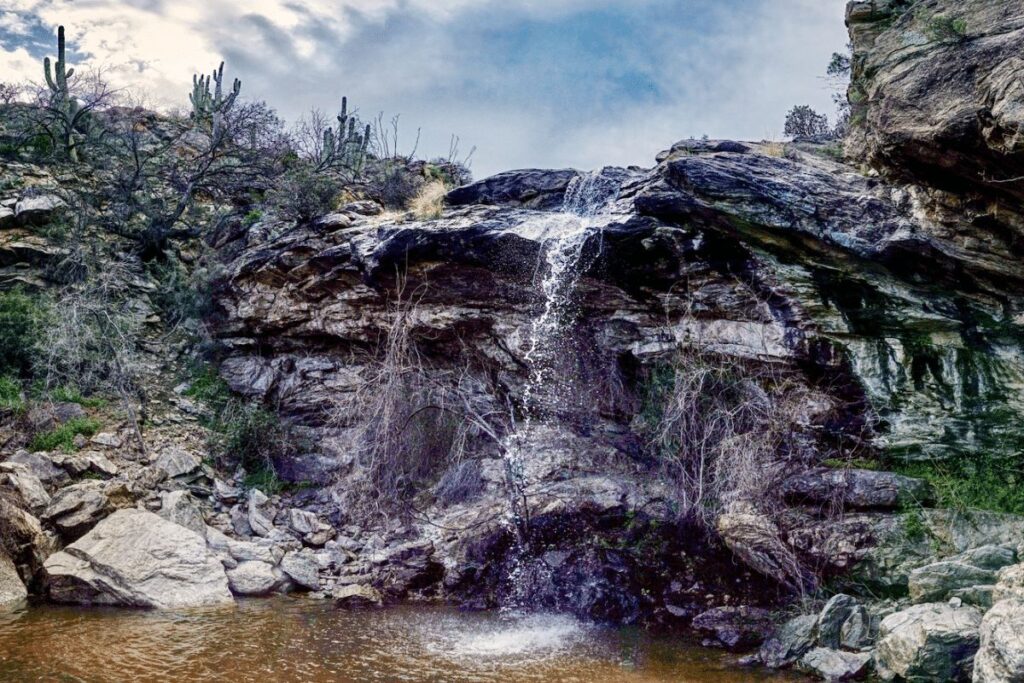
The hike to Bridal Wreath Falls is an out-and-back trail that is 5.5 miles in total length, with an elevation gain of 1060 feet. The trail is well-defined and easy to follow, with clear directions and mile markers along the way. This makes it an excellent option for hikers who are just starting out or those who prefer a guided route.
The first half mile of the trail is relatively flat, but the terrain soon becomes more challenging as hikers descend into the mountains. Despite the moderately-steep climb, the trail is still manageable for most hikers.
As you hike further along the trail, you’ll be treated to breathtaking views of the surrounding desert landscape, including saguaro and barrel cacti, mesquite, and creosote. If you visit during a wet season, you’ll be able to hear the sound of the waterfall before you see it.
As you round the bend, you’ll catch a glimpse of the falls before the trail curves to the opening. Although the falls themselves are small, they provide a peaceful and serene backdrop for a well-deserved rest and a snack before heading back down the same route you took.
Bridal Wreath Falls Trail is a wonderful hike that offers a mix of challenging terrain, stunning views, and a beautiful natural waterfall.
Rincon Peak Trail (16.2 miles)
The Rincon Peak Trail is a challenging hike with rewarding 360-degree views of Saguaro National Park. The trailhead is accessible by taking exit 297 for Mescal off I-10 and following a well-graded dirt road for 15.5 miles, which eventually enters private ranch land. A high clearance vehicle is recommended, though a passenger car can make it if driven slowly.
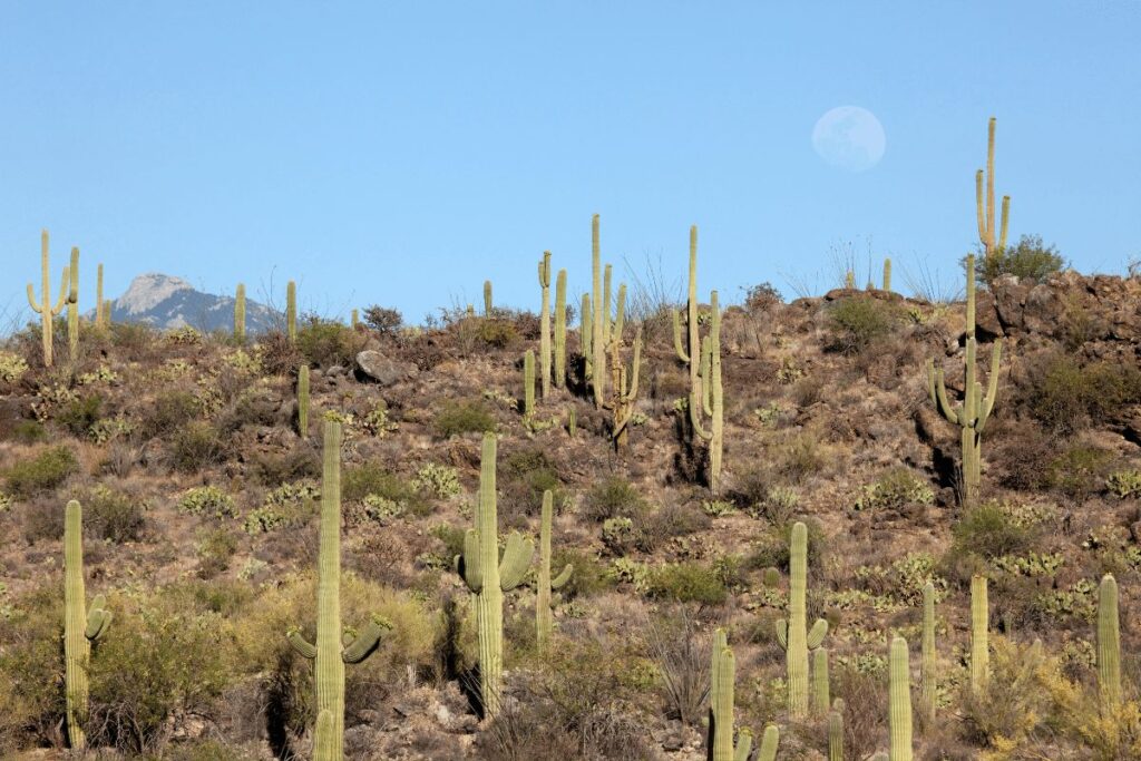
The hike begins at the Arizona Trail sign and passes through a shaded oak and manzanita forest beside Miller Creek. The trail becomes steeper as it climbs towards the base of Rincon Peak, offering views of the surrounding foothills. At a saddle, the trail descends briefly before continuing towards the peak, passing through a pine/juniper forest.
The final ascent to the summit is via a series of steep switchbacks, taking about 30 minutes to complete. At the summit, hikers are rewarded with stunning views and a cool (or cold) breeze.
The total length of the trail is 16.2 miles, and it is well-marked with signposts at all trail intersections. A high level of fitness is required for this hike, as it includes an elevation gain of over 4,000 feet. Hikers should also be prepared for weather changes, as it can be very cold at the summit even on a sunny day.
Brown Mountain Trail (8-mile)
If you’re looking for breathtaking views and some of the best hiking in Saguaro National Park, look no further than the Brown Mountain Trail. This popular trailhead is located just off of Highway 79 and offers a variety of trails to explore. For a moderate hike, take the Brown Mountain Loop Trail which winds through desert terrain and offers stunning views of the Huachuca Mountains.
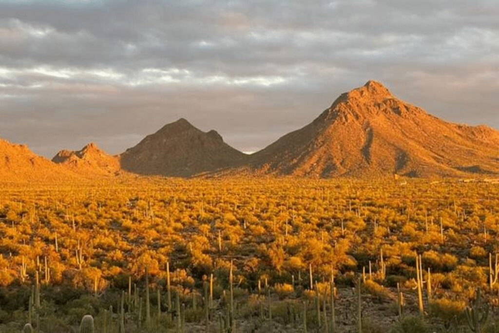
If you’re looking for breathtaking views and some of the best hiking in Saguaro National Park, look no further than the Brown Mountain Trail. This popular trailhead is located just off of Highway 79 and offers a variety of trails to explore.
For a moderate hike, take the Brown Mountain Loop Trail which winds through desert terrain and offers stunning views of the Huachuca Mountains. The loop is about 4 miles long and should take around 2-3 hours to complete.
For a more challenging hike, try the 8-mile round trip Brown Mountain Ridge Trail. This trail takes you to the top of Brown Mountain for panoramic views of the Sonoran Desert. The hike is strenuous with some steep sections, but it’s well worth it for the incredible views at the top!
Here is an informative video from the about the Saguaro National Park.
Signal Hill Trail (0.5-mile)
The Signal Hill Trail, located in Saguaro National Park in Arizona, is a popular hiking trail known for its stunning views of the surrounding landscape and unique rock formations. This moderate 0.5-mile trail is perfect for hikers of all skill levels and can be completed in about an hour.
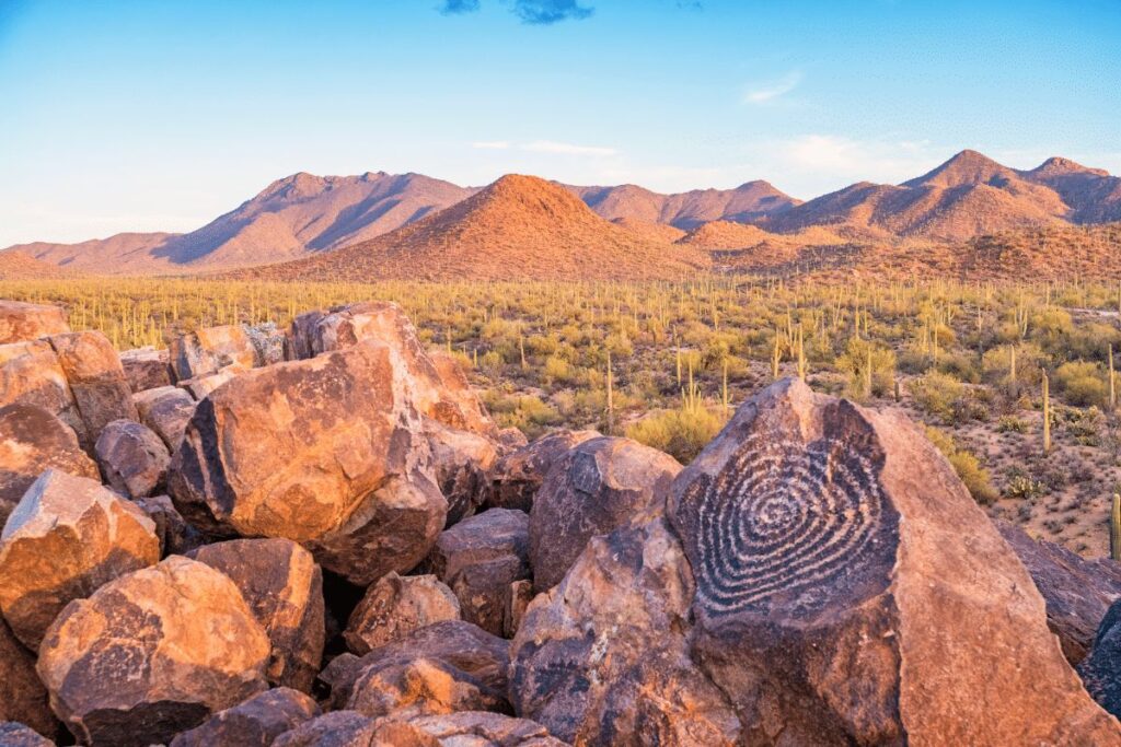
As hikers make their way up the trail, they will be greeted with panoramic views of the Sonoran Desert, including the towering saguaro cacti that the park is known for. The trail is well-maintained and clearly marked, making it easy for hikers to navigate.
One of the main attractions of the Signal Hill Trail is the large number of petroglyphs that can be found along the way. These ancient rock carvings, made by the Hohokam people over 800 years ago, depict various animals, people, and symbols that provide insight into the history and culture of the region.
At the end of the trail, hikers will reach Signal Hill, a large rock formation that offers sweeping views of the surrounding desert. This is a great spot to take a break and enjoy a snack while taking in the breathtaking scenery.
Signal Hill Trail is a must-visit destination for anyone traveling to Saguaro National Park. Whether you’re a seasoned hiker or just looking for a leisurely stroll, this trail has something for everyone. With its stunning views, fascinating history, and unique rock formations, the Signal Hill Trail is an unforgettable hiking experience.
Tanque Verde Ridge Trail (11 miles)
The Tanque Verde Ridge Trail is the primary route into the high elevation backcountry of Saguaro National Park, providing hikers with breathtaking views of the surrounding landscapes. The trail is 11 miles long and climbs steadily through several vegetation zones, gaining an elevation of 3,900 feet before reaching Cowhead Saddle.
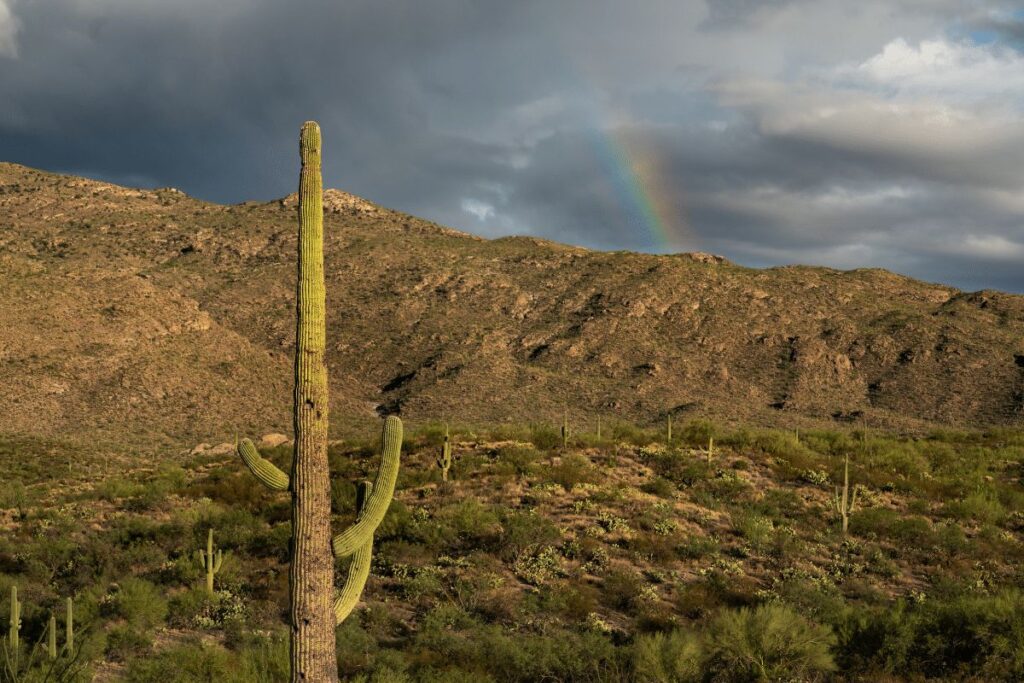
The trailhead is located at the Javelina picnic area, which can be accessed via the short two-way section of Cactus Forest Drive, 1.8 miles from the Saguaro National Park entrance station along the Old Spanish Trail. The trail is moderately difficult, with some steep and exposed sections, and is best hiked from fall to spring.
The trail starts gently on the north side of the ridge, traversing undulating terrain past a few rocky outcrops and dense cactus groves. The trail then climbs a little ravine beneath the first of many small summits, giving hikers their first views of lands to the southeast, before ascending further to the main ridgeline, which is followed for the remainder of the hike, generally staying just north of the crest.
Hikers can expect to experience several distinct changes in vegetation over the first few miles, from cholla, prickly pear, and dense forests of saguaro, through colonies of ocotillo, agave, and yucca, then into open grassland, followed by pinyon-juniper trees around 5,500 feet and ponderosa pine forests at the highest elevations. These varying vegetation zones make the hike all the more appealing.
The trail then ascends quickly to other intermediate summits, with steep sections followed by less steep or briefly level sections on the far side. Hikers will notice cholla cacti slowly fading away, eventually replaced by yucca, agave, nolina, and sotol, as the surroundings become generally more grassy.
One section of the trail right on the ridgetop and with views both north and south, comes within sight of an unusual cristate saguaro, at the foot of which are some less common escobaria vivipara cacti.
Half a mile past this location, the hillsides are more sparsely vegetated and the ground is mostly covered only by short grass, dotted with scattered bushes, making it less interesting in terms of plant life.
To the south, the ridge is now bordered by a deep valley (Box Canyon), which gradually narrows and becomes shallower. Towards its upper end, the path drops 150 feet, climbs again on the far side, and soon reaches somewhat flatter surroundings where pine and oak trees start to grow.
The route descends slightly again into the drainage that feeds Box Canyon and reaches the primitive campsite at Juniper Basin, which is one suitable target for a day hike.
Tanque Verde Ridge Trail is a must-hike for outdoor enthusiasts, with a medium usage level, and a five-star rating for its stunning views and varying vegetation zones.
The Wild Dog Trail (2.5 miles)
The Wild Dog Trail is a popular hiking trail located in the Santa Catalina Mountains in Arizona, USA. The trail is approximately 2.5 miles long and is considered to be of moderate difficulty. The trail offers hikers stunning views of the surrounding mountains, as well as a chance to see a variety of wildlife.
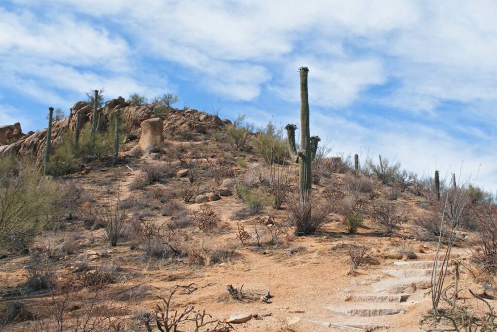
The trailhead is located at the end of Sabino Canyon Road, which is accessible by car or shuttle. The trail begins with a steep climb through a rocky and rugged terrain, which can be challenging for some hikers. However, the climb is well worth the effort as the trail soon opens up to expansive views of the Santa Catalina Mountains.
As hikers continue along the trail, they will encounter a variety of different environments, including rocky outcroppings, lush forests, and open meadows. The trail is well-marked and easy to follow, with clear signs at each junction to ensure that hikers stay on course.
One of the highlights of the Wild Dog Trail is the chance to see a variety of wildlife. The trail is home to a number of different species, including mule deer, javelina, and a variety of birds. Hikers may also spot a wild dog, which the trail is named after, although sightings are relatively rare.
Wild Dog Trail is a fantastic hike for those looking for a challenging and rewarding experience in the Santa Catalina Mountains. The trail offers stunning views, diverse terrain, and the opportunity to see a variety of wildlife. Hikers should come prepared with plenty of water and sturdy footwear, as well as a good sense of adventure.
Wildlife in Saguaro National Park
There is an abundance of wildlife to see while hiking in Saguaro National Park. Some of the most common animals include javelina, coyotes, deer, quail, and snakes. While you’re unlikely to see all of these animals on your hike,keep your eyes peeled and you may just spot one!

Woodpeckers, flycatchers, and wrens can also be heard in the park. Other birds like hawks, falcons, vultures, and owls can be seen soaring above the desert landscape. If you’re lucky you may even spot one of these feathered friends perched atop a cactus.
Smaller mammals like chipmunks, ground squirrels, jackrabbits and packrats can also be found scurrying around the park.
Reptiles such as lizards and turtles are also common visitors to Saguaro National Park. Not only do they make for interesting viewing but reptile species provide important ecological functions such as controlling insect populations.
In addition to its array of terrestrial animals, Saguaro National Park is home to a wide range of amphibians as well as aquatic creatures such as frogs and fish.
Also Read: 12 Animals In Saguaro National Park We Saw While Hiking!
These creatures help maintain a balanced ecosystem that supports the larger wildlife population in the area and provides key functions to the environment such as water filtration.
Conclusion
Saguaro National Park is a breathtaking place for anyone to explore. With seven of the best hiking trails in the area, it’s no wonder why so many people plan their trips around this magical location.
Whether you’re looking for an adrenaline rush or just want to soak up some gorgeous views and bask in nature’s beauty, these trails are sure to provide an unforgettable trip.
Have you been on any of the trails we included? What did you think? Did we miss out your favorite trail? Let us know by leaving a comment below!


