Explore Lamar Valley, Yellowstone's top wildlife sanctuary. From its mesmerizing landscapes to wildlife dramas, this guide unveils its majestic terrains and highlights.
Stepping into Lamar Valley feels like opening a time-locked door into America’s wilderness past.
Renowned as Yellowstone’s premier wildlife sanctuary, this expansive valley is a medley of sprawling meadows, meandering rivers, and silent mountains watching over.
From elusive wolf packs orchestrating dawn hunts to herds of bison leisurely grazing, Lamar Valley serves as a bustling canvas of nature’s raw drama.
But it’s not just about the animals; the valley’s landscape, shaped by ancient volcanic eruptions and sculpted by glaciers, narrates a geological epic spanning millions of years.
So, if you’re seeking an authentic taste of Yellowstone’s wild essence, there’s no place quite like Lamar Valley. Let this guide be your compass through its majestic terrains.
Lamar Valley: Yellowstone’s Wildlife Haven
When you think of Yellowstone, images of erupting geysers and shimmering lakes might be the first to dance in your mind. But nestled in the park’s northeastern corner is a treasure that steals the hearts of many: Lamar Valley.
Now, calling Lamar Valley the “Serengeti of North America” might sound like a lofty claim, but spend an hour here, and you’ll see why.
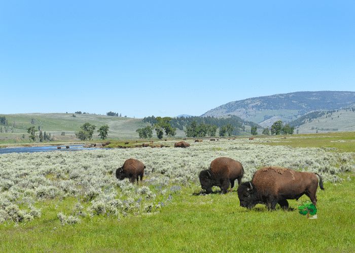
The vast, rolling grasslands framed by the distant embrace of rugged hills paint a scene straight out of a wilderness dream.
Its on this very canvas that nature performs its daily ballet.
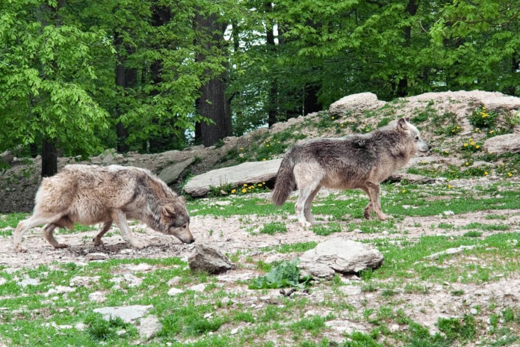
What makes Lamar Valley a true standout? For starters, it’s one of the rare places in the U.S. where you can watch wolves in the wild.
After their triumphant return to Yellowstone in the 1990s, these majestic creatures have favored the landscapes of Lamar Valley.
Witnessing a wolf pack coordinating a hunt or hearing their haunting howls cut through the crisp air is an experience that’s hard to put into words.
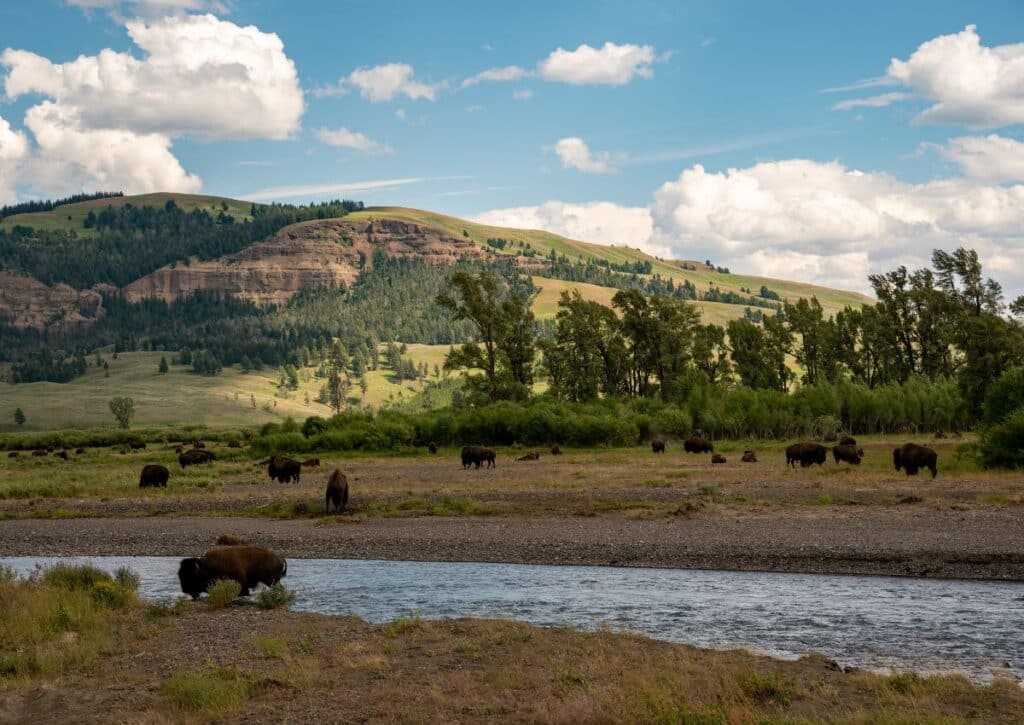
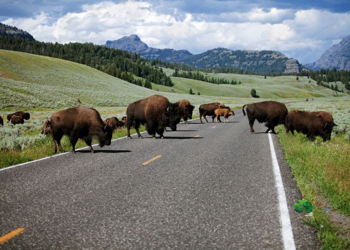
But the magic doesn’t stop with the wolves. Wander here and find bison herds, their massive frames dotting the plains as they graze, a throwback to a time when they dominated the American West.
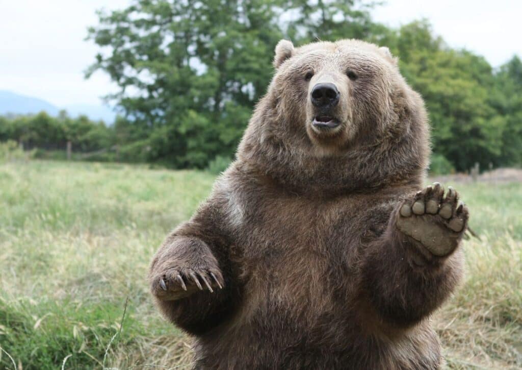
Add to this mix the elegance of elks, the speed of pronghorns, and the occasional sighting of a grizzly bear, and you’ve got a wildlife lover’s paradise.
It’s not uncommon to see visitors perched patiently with cameras and binoculars, eyes gleaming with anticipation.
They’re waiting for that one unforgettable moment, that perfect shot. And honestly, in Lamar Valley, it’s not about if you’ll get that moment, but when.
Coming here is not just another tick off the bucket list. It’s a journey, an adventure. It’s feeling the pulse of Yellowstone’s wild heart and understanding, even if just a little, the rhythms of the natural world.
The Mesmerizing Lamar River
Amid the grandeur of Yellowstone’s vast landscapes lies a jewel that flows with timeless grace: the Lamar River.
Winding its way through the heart of the famed Lamar Valley, this river is more than just a waterway; it’s the lifeblood of the region, bringing sustenance, beauty, and adventure to all who encounter it.
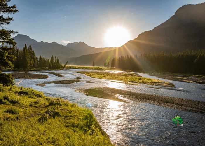
Originating in the Absaroka Range, the Lamar River courses through approximately 40 miles before surrendering to the Yellowstone River.
Along its journey, it nourishes lush meadows, dense forests, and an incredible diversity of wildlife.
It’s not unusual to spot a herd of elk quenching their thirst by its banks or an osprey diving into its waters for a fresh catch.
But the Lamar River is not just about the wildlife it supports. It’s a storyteller. Its waters carry tales of ancient glaciers that sculpted the land and the native tribes who revered it as a sacred source of life.
The river has witnessed epochs of change, yet it continues to flow with an enduring constancy.
One unique feature is the “Lamar Valley Canyon,” a rugged stretch where the river has carved its way through volcanic rocks, creating breathtaking vistas and offering white-water enthusiasts a thrilling ride.
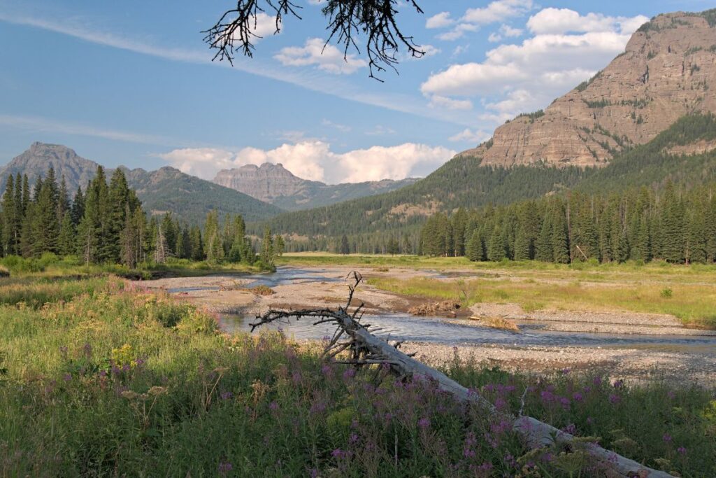
Anglers, too, find solace by its banks. The river is renowned for its cutthroat trout, making it a coveted spot for fly fishing.
Beyond the adrenaline and the serene moments, the Lamar River holds cultural significance.
Native American tribes, especially the Crow people, have deep-rooted connections to this river, seeing it as a spiritual entity, a giver of life and wisdom.
For Us – the Lamar River is not just a spectacle to admire from a distance. It invites you in, urging you to listen to its tales, partake in its adventures, and cherish its invaluable contributions to the ecosystem.
Whether you’re an avid nature lover, an adventure seeker, or simply a curious traveler, the Lamar River promises an experience that resonates deeply, reminding you of nature’s timeless dance.
The Iconic Lamar Valley Scenic Drive
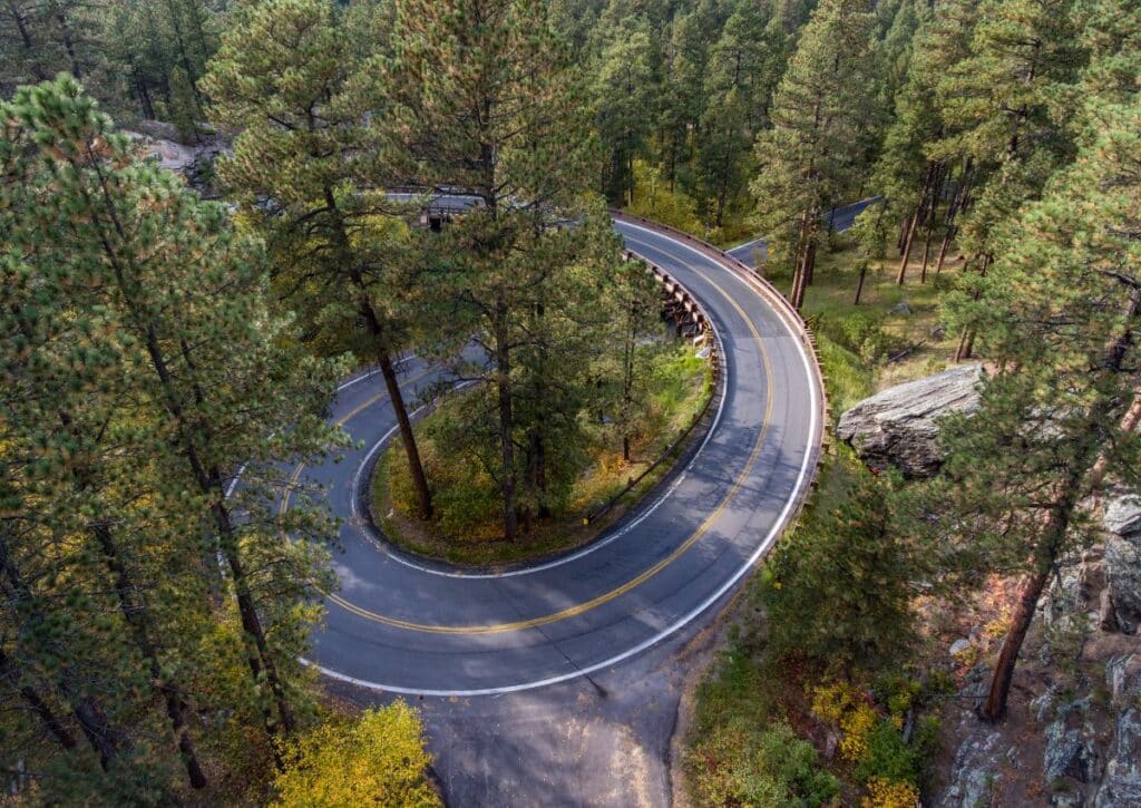
Spanning a remarkable distance in the heart of Yellowstone’s northeastern region, the Lamar Valley Loop Drive is not just a road, but an invitation into the raw essence of the American wilderness.
A comprehensive circuit that offers a symphony of sights and sounds, this loop drive is an adventure that encapsulates the magic of Yellowstone in every mile.
Beginning at the historical Roosevelt Junction, named after President Theodore Roosevelt, the drive stretches across a vast expanse that is quintessentially American West.
he loop, approximately 29 miles long, offers a series of landmarks and experiences that change with every curve and turn.
Your first greeting is the ancient Soda Butte, a dormant thermal cone that stands as a silent guardian of the valley’s past.
The early morning light, casting a golden glow over it, makes this spot a photographer’s delight.
As you continue, the shimmering flow of the Lamar River becomes a constant companion.
With several pull-over points along the drive, you have ample opportunities to step out, breathe in the crisp air, and perhaps spot elks or pronghorns by the riverbanks.
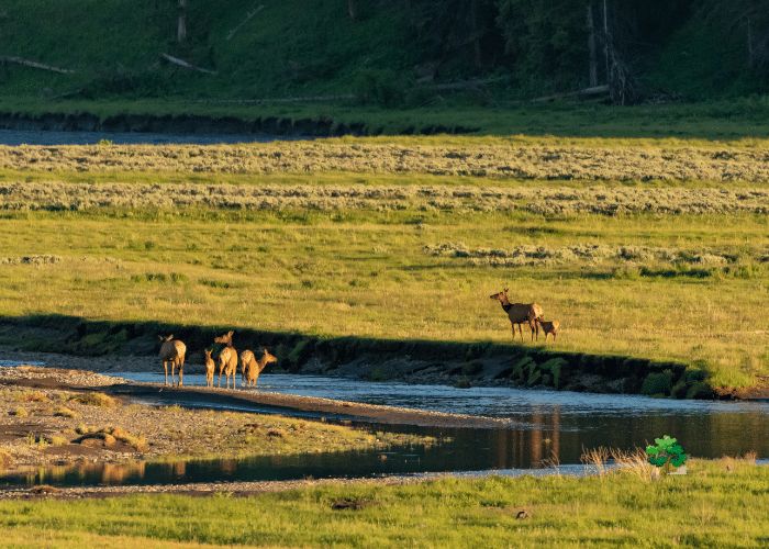
It’s a serene experience, with the gentle whispers of the river narrating tales of the land.
The loop’s character shifts as you delve deeper. Dense forests of fragrant pines envelop the drive, where hidden gems like Rainy Lake and Caldera Rim punctuate the journey.
These are the valley’s best-kept secrets, offering panoramic vistas and peaceful picnic spots.
What truly elevates the Lamar Valley Loop Drive is its status as Yellowstone’s premier wildlife viewing corridor.
Whether it’s the regal bison causing delightful traffic jams or the elusive wolf packs roaming the plains, nature’s spectacle is in full display here.
So immerse in this experience, all it takes is patience, a keen eye, and a heart open to wonder.
As you approach the culmination of the loop, a slight detour beckons at Trout Lake. This serene alpine lake, a brief hike away from the main road, promises tranquility and the charming antics of otters.
By the time you circle back to Roosevelt Junction, having traversed the full length of the loop, you’d have journeyed through epochs of geological history, diverse ecosystems, and the very soul of wild America.
It’s an experience that imprints itself, reminding you of the grand tapestry of nature and our humble place within it.
Soda Butte
Lamar Valley in Yellowstone is a treasure trove of scenic wonders, and among them, Soda Butte stands tall and proud.
Think of it as the valley’s welcoming beacon. It’s hard to miss and even harder to ignore.
Why? Because Soda Butte isn’t just any hill in the valley. It’s where you go for panoramic views that will leave you spellbound.
Gazing out, you see all of Lamar Valley, stretching out with its wildlife and natural beauty.
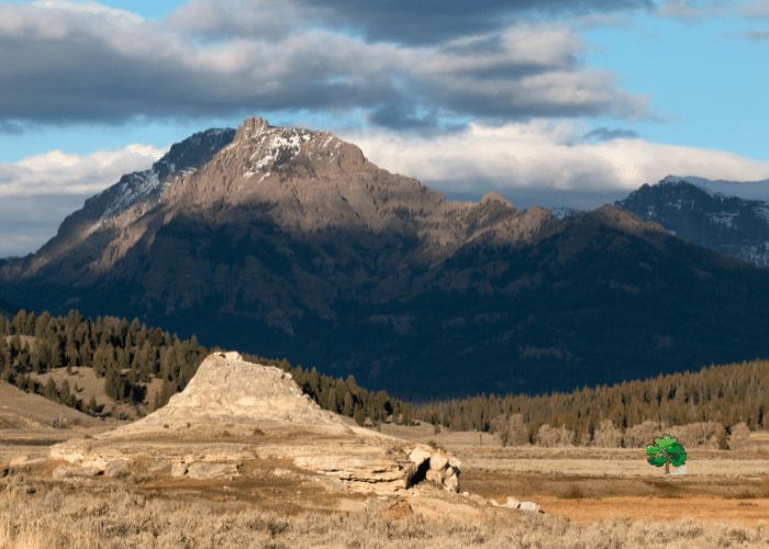
Speaking of wildlife, Lamar Valley didn’t disappoint. Right around Soda Butte, we got front-row seats to nature’s show.
Deer pranced, bison roamed, and birds soared. And just when we thought it couldn’t get any better, an eagle flew majestically past, a sight to remember.
If you’re wondering where to start this adventure, head to Soda Butte Creek Campground. It’s located just off Highway 191, not far from West Yellowstone.
The trailhead begins at the campground, clearly marked and easy to find.
Though the trail is perfect for solo hikers, it might get a bit cozy if you’re in a group.
It’s a path that skirts Soda Butte Creek, sometimes going through trees and rocky terrains, but always staying close to the water’s gentle whispers.
But here’s the thing: Soda Butte isn’t just about the peak or the creek. It introduces you to the bigger picture – the mountains of Lamar Valley.
They stand tall around the valley, giving a dramatic backdrop to an already stunning landscape.
In all, this short 45-minute hike gives you a taste of what Lamar Valley is all about. Beautiful landscapes, incredible wildlife, and moments that make you appreciate the simple wonders of nature.
So, if you’re in Yellowstone, make sure Lamar Valley, with Soda Butte as its starting point, is on your must-visit list.
Lamar Valley is Surrounded by Mountains
Lamar Valley in Yellowstone National Park is a treasure trove of natural wonders, but its surrounding peaks are the unsung heroes, framing the valley with their majestic profiles and age-old tales.
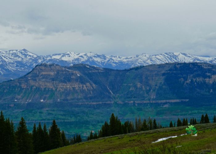
Lamar Valley’s Mt Washburn
Rising to 12,013 feet with its North Washburn Peak and flanked by the slightly shorter South Washburn Peak at 11,716 feet, Mt Washburn is a beacon of the northern Lamar Valley landscape.
Its dual peaks are the remnants of ancient volcanic activity, with the last major eruption occurring around 800 years ago.
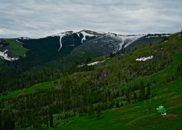
This eruption was so vast, it changed the course of many Native American tribes who once called this area home.
Today, Mt Washburn is a favorite amongst trekkers, offering panoramic views of Yellowstone, each viewpoint a window to the valley’s vast biodiversity.
Bison Peak
At 5,923 feet, Bison Peak might not be the tallest, but its significance is undeniable.
Named after the thriving bison population at its base, it’s estimated that over 1,000 bison roam here.
From its summit, the panoramic expanse of Lamar Valley unfolds, from the meandering Lamar River to the distant horizons.
Local legends whisper of the mountain being the ancient protector of these bison, watching over them through centuries.
The Thunderer of Lamar Valley
Erosion, time, and ancient volcanic activity have shaped The Thunderer into the impressive mountain we see today.
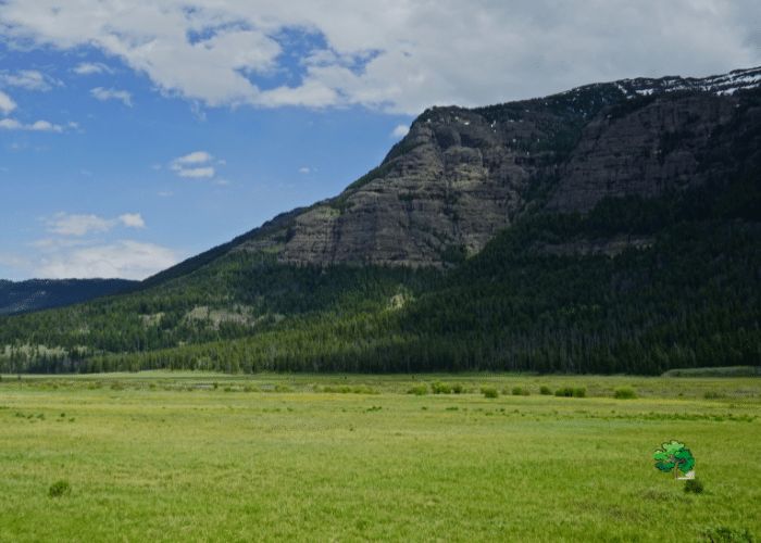
A masterpiece of nature’s craft, The Thunderer looms at 9,903 feet, its slopes bearing traces of basaltic lava flows from an eruption 2 million years ago.
This mountain isn’t just a sight to behold but is also an audible wonder. On stormy days, the gusts create echoing sounds, giving an illusion of thunder, leading to its evocative name.
The peak also provides a unique vantage point, where sightings of bison, wolves, and even grizzly bears are not uncommon.
Lamar Valley’s Specimen Ridge
This isn’t just another mountain ridge; it’s a museum of natural history. The ridge showcases fossilized trees that date back over 2 million years, preserved in a time capsule by volcanic ash.
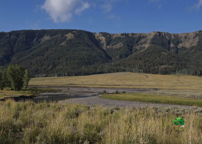
With two distinct summits, East and West Specimen Peaks, it rises as a sentinel above the Lamar Valley, offering insights into the region’s geological evolution.
The ridge’s formation, known as a horst, and the sharp edges carved by ancient glaciers, make it a geological marvel in Yellowstone’s landscape.
We went as far as Trout Lake
As you move beyond the sprawling plains of Lamar Valley, a new kind of enchantment awaits: the tranquil embrace of Trout Lake.
Situated a modest distance away, the journey to this shimmering gem winds through meadows adorned with wildflowers and rustic trails echoing with the distant calls of local birds.
Upon arrival, the lake’s crystal-clear waters mirror the surrounding pines and mountain peaks, offering a picturesque vista that seems straight out of a painter’s canvas.
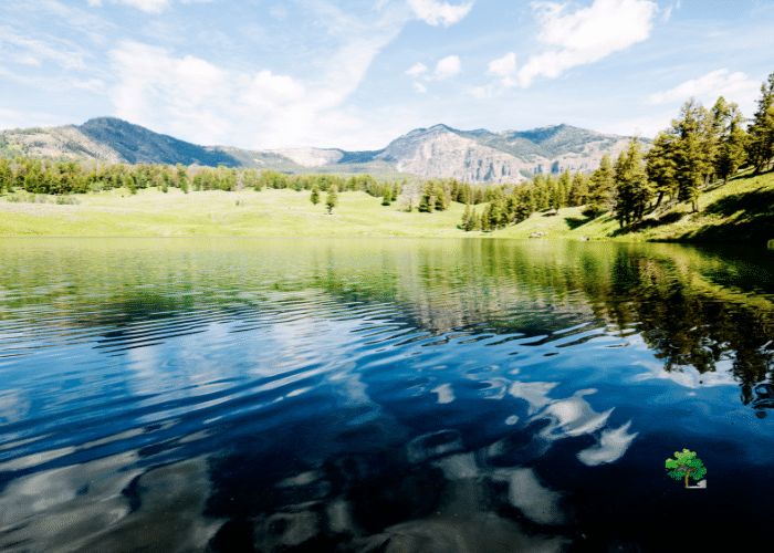
But it’s not just the views that captivate. Trout Lake teems with life – cutthroat and rainbow trout play hide and seek beneath its surface, making it an angler’s paradise.
For those less inclined towards fishing, the gentle trails around the lake promise peaceful walks, where every step brings forth ever-changing views and perhaps an encounter with the lake’s many resident critters.
The gentle murmur of water, combined with the crisp mountain air, ensures a meditative experience.
So, whether you’re stretching your legs after the grandeur of Lamar Valley or seeking a quiet respite amidst nature’s wonders, the journey from Lamar to Trout Lake is a soulful detour worth taking.
12 Things That Make Lamar Valley Unmissable
For us, these are the things that come to mind when you say “Why Go to Lamar Valley?”
Dawn’s Ethereal Embrace
Lamar Valley at sunrise is nothing short of poetic. The day breaks gently, casting a golden spell across the land. The initial soft light gradually intensifies, dispelling the morning fog and revealing bison and elk moving languidly.
This serene scene serves as a daily reminder of nature’s daily rebirth, a spectacle that every visitor should prioritize.
The Realm of Wolves
Few places rival Lamar Valley when it comes to wolf sightings. With the densest concentration of these predators in North America, the valley provides ample opportunities to observe their behaviors.
Wolves, often seen in packs, roam the vast stretches, communicating through evocative howls that echo through the region. These moments, watching the wild canines interact, hunt, and play, are raw insights into the essence of wilderness.
Bison: The Titans of the Plains
The Lamar Valley resonates with the thunderous footfalls of its bison population. These behemoths, symbolic of America’s wild heart, dominate the landscape.
Whether seen during their slow marches, territorial disputes, or tender moments between mother and calf, they embody the spirit of the untamed.
The valley gives one the privilege of observing these majestic beasts up close, a connection to a bygone era.
Landscape’s Visual Symphony
The valley’s scenic allure is as powerful as its wildlife. Diverse terrains, from rolling grasslands to meandering rivers, paint a dynamic tapestry.
Sunsets bathe the landscape in warm tones, while shadows of passing clouds introduce ever-changing patterns.
Every glance captures a different facet of Lamar’s multifaceted beauty, making each visit feel fresh and unique.
A Pause from Modern Hustle
In an age of digital immediacy, Lamar Valley is a sanctuary of tranquility. Time here moves at nature’s deliberate pace.
Days are dictated by the grazing herds, rivers’ flow, and avian flights, rather than ticking clocks.
It’s a place to reconnect, to breathe, and to find solace in life’s simple, unhurried rhythms.
Pronghorn: Grace in Motion
Often overlooked, pronghorns add to the valley’s vibrancy. With their unique horned silhouettes and unmatched speed, they dash across plains in a blur.
Witnessing their nimbleness, especially during their playful chases or when they evade potential threats, is a testament to nature’s design perfection.
Shadows Hide Giants
Amidst the grass and behind the trees, grizzlies and moose occasionally emerge. Their sightings, albeit sporadic, are thrilling.
The sheer might of a grizzly or the majestic stride of a moose amplifies Lamar’s wildlife treasure trove.
Each glance around can surprise, teaching visitors the virtue of patience and the joy of unexpected rewards.
Avian Splendors
The skies of Lamar Valley offer their own dynamic theater. Eagles, ospreys, and hawks command the skies, each showcasing distinctive aerial acrobatics.
Their dives, flights, and calls are a constant reminder of the vibrant life above, making the valley a birdwatcher’s dream.
Ecosystem’s Delicate Balance
Beyond the prominent, the valley houses an intricate web of life. From insects pollinating flowers to amphibians in the waterways, every organism plays a role.
This biodiversity, evident in the harmonious coexistence of species, is a living lesson in ecology and interdependence.
Life in Liquid Form
Lamar’s rivers and streams aren’t just picturesque backdrops. They nurture life. Fish dart, amphibians thrive, and larger mammals often approach for a drink.
These waterways are lifelines, and their banks serve as prime spots to observe diverse wildlife interactions.
Night’s Cosmic Ballet
Once the sun dips below the horizon, Lamar’s skies light up with a celestial spectacle.
The clear atmosphere, devoid of light pollution, offers vivid views of constellations, meteors, and the Milky Way.
Stargazing here is a humbling experience, a reminder of our tiny presence in the vast cosmos.
Seasons’ Diverse Palettes
Every season ushers in a new look for Lamar Valley. Spring blooms, summer greens, autumn golds, and winter whites—each phase has its distinct charm.
These cyclic transformations ensure that no two visits are identical, with each offering new perspectives and experiences.
From its raw wilderness to its tranquil moments, Lamar Valley stands as an ode to nature’s grandeur, awaiting those who seek genuine encounters with the wild.
What Do You Need To Bring To Lamar Valley?
Lamar Valley, a gem within Yellowstone National Park, promises unparalleled wildlife sightings, breathtaking landscapes, and memories that last a lifetime.
But to make the most of this sanctuary of the wild, it’s crucial to come prepared.
Here’s your go-to packing list for a fulfilling Lamar Valley experience:
1. Optics: A pair of high-quality binoculars or a spotting scope is indispensable.
They magnify the thrill of wildlife watching, ensuring you don’t miss out on distant wolf packs, pronghorns in full sprint, or eagles soaring high.
2. Camera and Accessories: Whether you’re an amateur or a professional, bring along a reliable camera with a zoom lens to capture the valley’s magic.
Don’t forget extra batteries, memory cards, and lens protectors to guard against dust and moisture.
3. Weather-Appropriate Clothing: The mountainous terrain means unpredictable weather. Layered clothing is key.
During summers, light layers with a waterproof jacket are ideal, while winters demand insulated, waterproof clothing. Always include a hat and sunglasses.
4. Sturdy Footwear: Given the varied terrain, a pair of comfortable hiking boots is essential. Ensure they’re waterproof and broken in to prevent blisters.
5. Navigation Aids: While the valley is well-marked, a map of the area and a compass (or a GPS) can be handy, especially if you plan to wander off the beaten paths.
6. Food and Water: Pack enough snacks and a refillable water bottle. Remember, it’s vital to store food properly to not attract wildlife.
7. Safety Gear: This includes bear spray (know how to use it!), a basic first-aid kit, and a whistle. Given the region’s dense bear population, safety should be paramount.
8. Sun Protection: The sun can be deceptively harsh. Pack a good sunscreen, lip balm with SPF, and sunglasses to shield against UV rays.
9. Camping Gear: If you’re staying overnight, ensure you have a reliable tent, a warm sleeping bag, and a camping stove.
10. Eco-friendly Essentials: Given the pristine nature of Lamar Valley, pack biodegradable soap, reusable cutlery, and bags to carry out trash. Leave no trace behind!
Venturing into Lamar Valley is a journey into the heart of the wild. But with the right gear and a spirit of adventure, it transforms into an experience of a lifetime.
When to Visit Lamar Valley for the Best Wildlife Encounters
Lamar Valley in Yellowstone is fondly nicknamed the “Serengeti of North America” for its prolific wildlife sightings.
However, the magic of Lamar varies through the year. Here’s a monthly guide to optimize your wildlife-watching experience:
January – February: The harsh cold of winter means fewer tourists. It’s also the best time to spot wolves.
The white landscape makes them easier to see.
Additionally, bison herds can be observed, their dark figures contrasting starkly against the snow.
March – April: Spring brings baby animals! Expect to see young bison and elk calves.
Grizzly bears might make an appearance as they emerge from hibernation, often seen foraging in meadows.
May: This is the peak birthing season for many animals.
Baby bears, bison, and elk are commonly sighted.
Also, keep an eye out for pronghorns and bighorn sheep.
June: The valley blossoms with wildflowers, offering a picturesque backdrop for wildlife sightings.
Birds, especially raptors, are very active during this period.
July: As temperatures rise, many animals move to higher altitudes.
However, early mornings and evenings can be fruitful for watching wolves, bears, and bison.
August: A good month for birdwatchers, as migratory birds begin their journeys.
You may also spot bison in rut, with males engaging in fierce battles.
September: Fall starts to set in, coloring the valley in golden hues.
Elk rut is the highlight of this month, with their haunting bugles echoing through the valley.
October: Grizzlies can often be seen preparing for hibernation, gorging on fruits and nuts.
The valley becomes quieter, marking a transition into the colder months.
November: A serene time to visit, with fewer tourists.
Watch out for large herds of bison and the occasional sight of wolves.
December: A winter wonderland! While wildlife is less active, the beauty of Lamar Valley covered in snow is unparalleled.
Wolves and bison are the primary attractions this month.
Every month in Lamar Valley presents unique wildlife encounters.
Plan according to your interests, and remember that early mornings and evenings are generally the best times for sightings, regardless of the season.
Dining Options Around Lamar Valley
When planning a trip to Lamar Valley, nourishing your body is just as essential as packing your binoculars. While the valley itself is a remote wilderness, there are several dining options in and around Yellowstone to ensure you’re well-fueled for your adventure.
1. Roosevelt Lodge Dining Room: Located near the northeastern entrance of Yellowstone and a stone’s throw from Lamar Valley, Roosevelt Lodge offers a rustic dining experience.
Their menu is inspired by what one might call ‘cowboy cuisine’ – think hearty stews, grills, and dutch oven specialties. Don’t miss their famous baked beans!
2. Cooke City and Silver Gate: These tiny towns, situated just outside the Northeast Entrance of Yellowstone, are your best bet for diverse dining options close to Lamar Valley.
From cafes like Beartooth Café offering home-cooked meals to Miner’s Saloon for a more laid-back pub experience, there’s something to satiate every palate.
3. Canyon Village: Although a bit farther from Lamar Valley, Canyon Village provides more dining variety.
Canyon Lodge Eatery offers a range of options, from burgers to salads, and there’s also a delicatessen for those wanting to grab a quick sandwich or wrap.
4. Pack a Picnic: For those wanting to make the most of their time in Lamar Valley, packing a picnic might be your best option.
Stop by any general store in Yellowstone, like the one in Tower-Roosevelt, to stock up on sandwiches, snacks, and beverages.
Enjoy your meal amidst nature, but always remember to pack out your trash and maintain a safe distance from wildlife.
5. Gardiner, Montana: Just outside Yellowstone’s North Entrance, Gardiner boasts several eateries.
From the organic offerings of Tumbleweed Bookstore and Café to the juicy burgers of Wonderland Café & Lodge, there are options aplenty.
Whichever option you choose, ensure you’re energized for your Lamar Valley experience.
After all, spotting wolves, bison, and the valley’s breathtaking vistas requires both patience and enthusiasm!
Concluding the Lamar Valley Experience
Lamar Valley, often heralded as the ‘Serengeti of North America’, offers a spellbinding tapestry of nature at its finest.
From the mesmeric hues of sunrises that bathe the land in gold to the unparalleled wildlife encounters, Lamar Valley is more than just a destination—it’s an emotion.
The valley beckons with its rolling terrains, majestic mountains, and glistening waters of the Lamar River.
Each season provides its own unique flavor of experiences, be it the playful gallops of bison in summer or the distant howls of wolves in winter.
It’s not just about what you see, but also about how you prepare. From understanding the best times for wildlife sightings to packing the right gear and knowing where to satiate your hunger, every detail enriches the Lamar experience.
And as you traverse the valley, whether by foot, car, or even thoughts from afar, the memories created here will undoubtedly echo in your heart for years to come.
